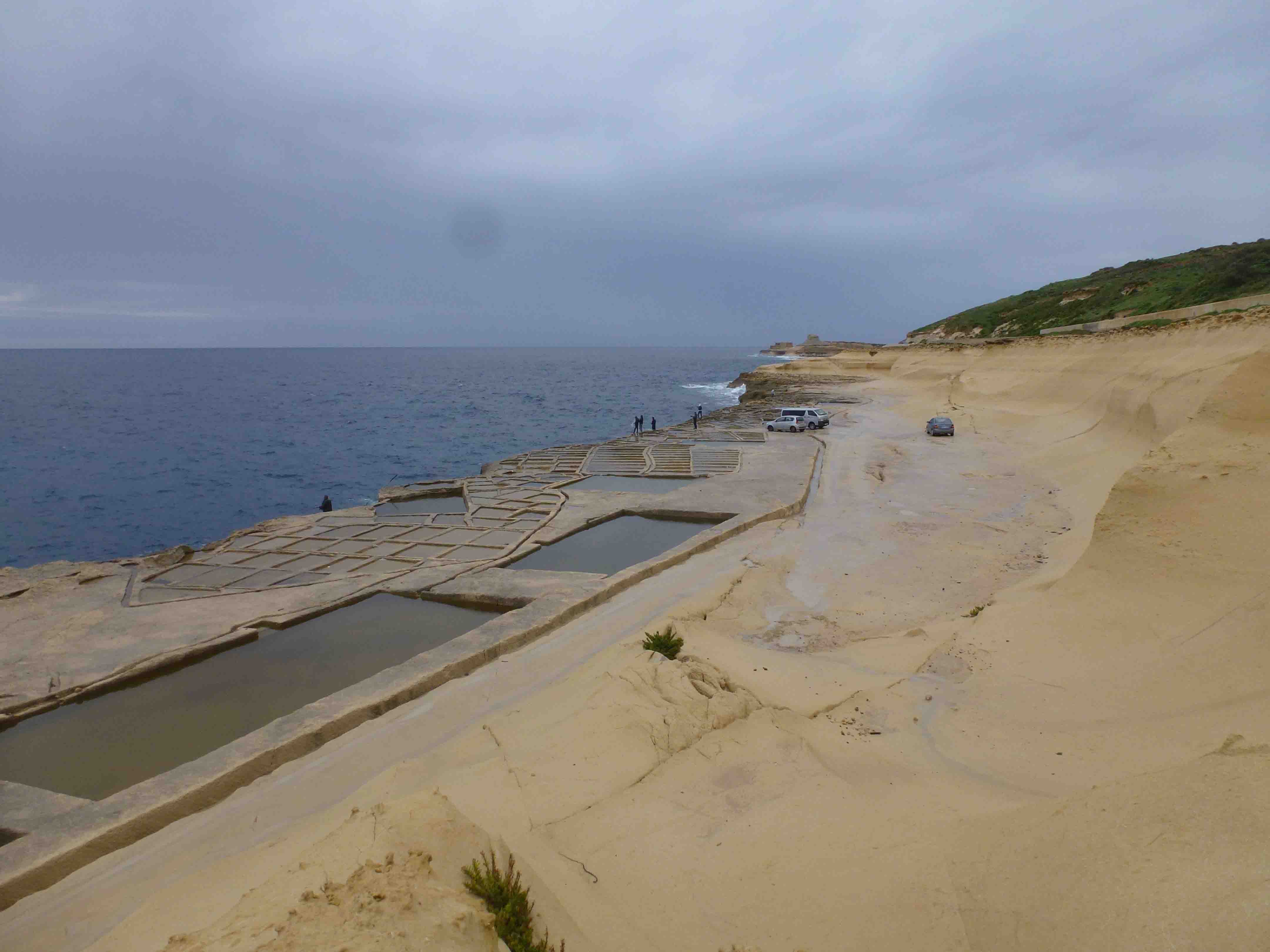
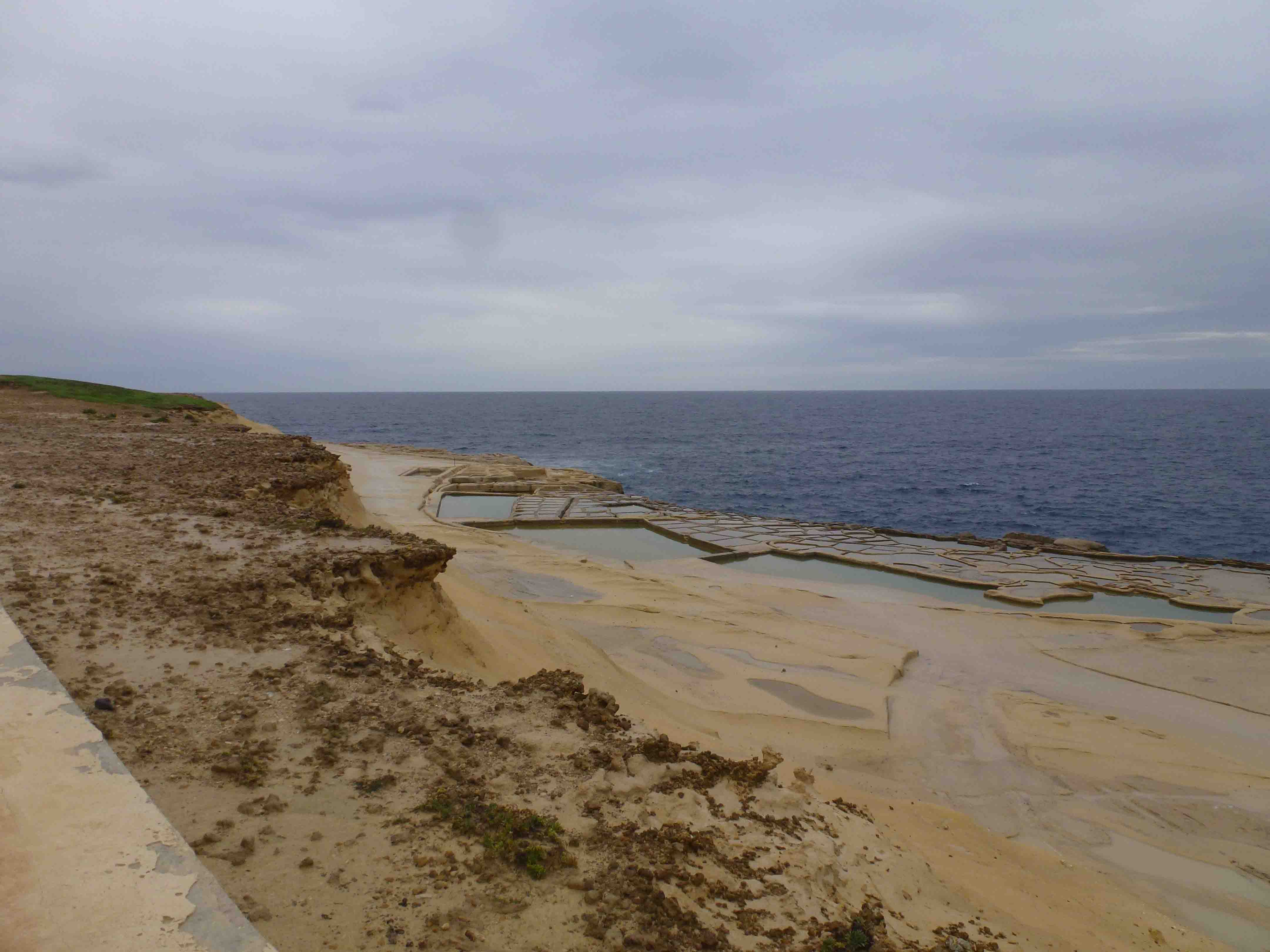
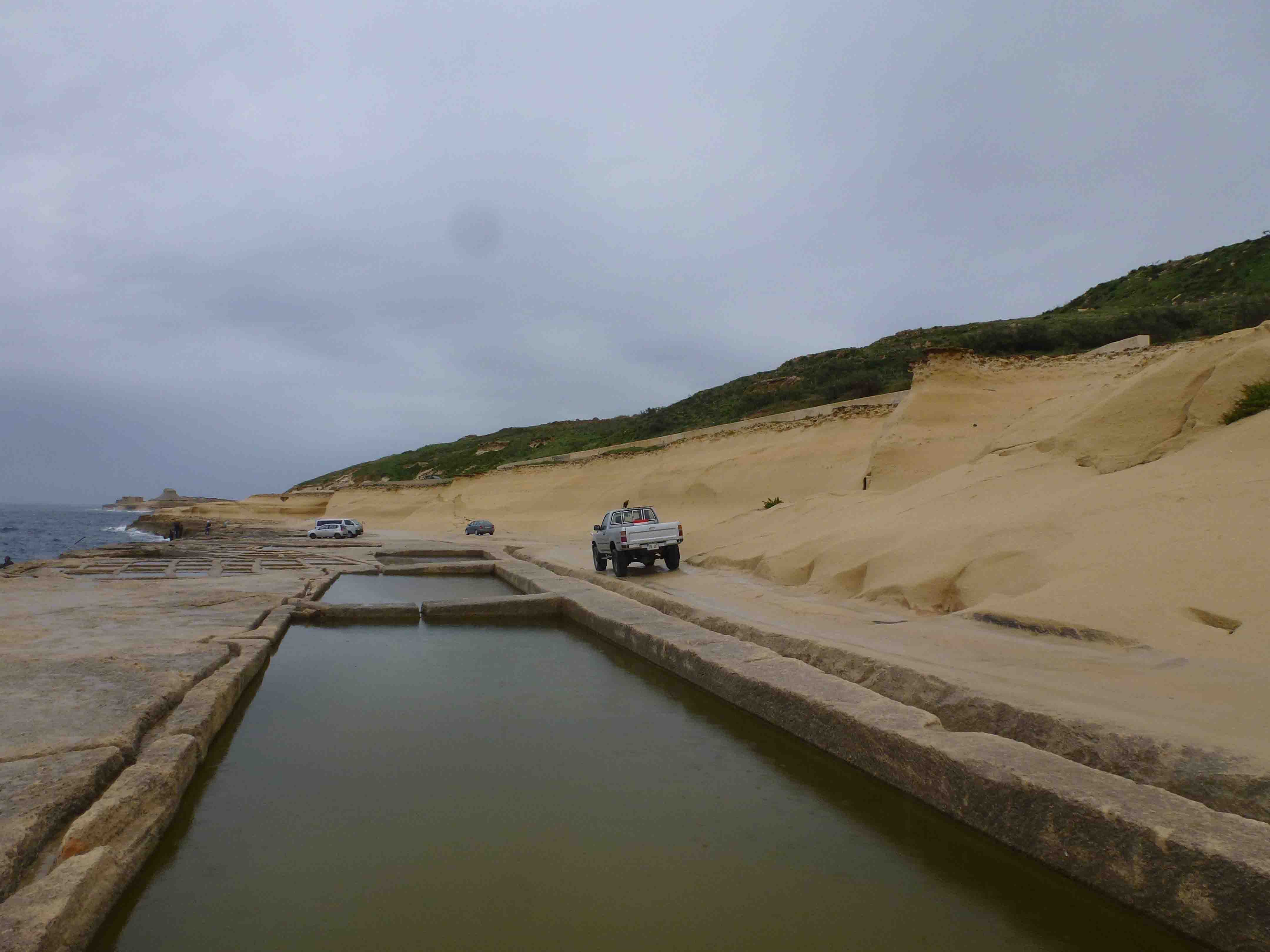
Northern Gozo Salt Pans are a series of salt pans along the coast in northern Gozo within Iz-Zebbug’s administrative area. The site is accessible from Iz-Zebbug or from Xwejni Bay. The salt pans cover an area of approximately 88,240 m2. The site is still actively being used for salt production and tours are done by the owners of the site. The surrounding basin include a coast road, agricultural land and an old disused landfill which is located on elevated ground. There is no vegetation present within the site or its basin. There is no data present regarding wildlife, however, it is likely that marine fish and insects to be present.
Wetland data
Basic information
Wetland location:
Marine/Coastal
Wetland type:
Artificial
Wetland area:
8.80 Ha
Hydrological interaction:
-
Water salinity:
Salty (> 18.0 g/l)
Type of fresh water input:
Catchment area (precipitation)
Surface water runoff
Other
Open water area (%):
76 - 95
Hydroperiod:
Permanent
Geographic information
Census district:
Gozo and Comino
Island:
Gozo
Local council:
Iz-Zebbug
Longitude:
14.237250 East
Latitude:
36.080820 North
Biological significance
Biological significance:
Low
Ramsar wetland type
Type
Coverage (%)
5 -- Salt exploitation sites; salt pans, salines, etc.
Property status
Public
Ecosystem services
Type of ecosystem service
Ecosystem service
Scale of Βenefit (%)
Importance
Cultural services
Cultural heritage
Supporting services
Provision of habitat
Activities on wetland
Activity
Intensity
020 = Resource conservation
High
340 = Salt works
High
Activities on catchment area
Activity
Intensity
501 = paths tracks cycling tracks
High
621 = nautical sports
High
800 = Landfill land reclamation and drying out
High
Impacts
Impact
Intensity
EB- = Increase in aesthetic qualities
High
EE- = Increase of economic potential
High
EF- = Increase in protection from natural forces
EO- = Increase potential for natural products
EU- = Increase of tourist/recreation potential
Images
Nature Trust Malta. (2019). MtIsWet – Database of the Maltese Islands Wetlands. Updated: 04.2024