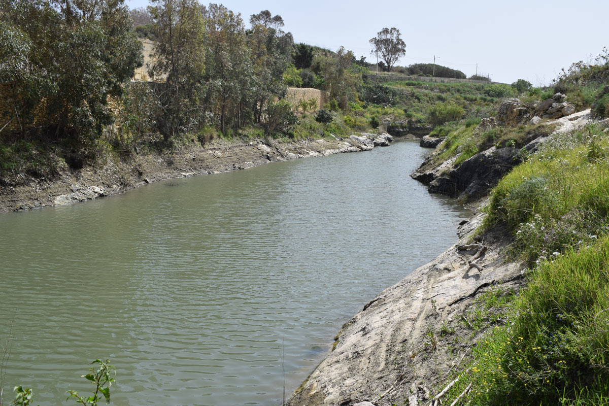
Wied ta’ Marsalforn is an artificial dam lake constructed within Wied ta’ Marsalforn, located in northern Gozo within the limits of Marsalforn. The site is not easily accessible by the public, however it is possible from a nearby surfaced road. The dam lake covers an approximate area of 1,700m2. The purpose of this dam lake is unclear due to the absence of irrigation pipes, however it is likely it had been constructed as a flood mitigation measure. Abandoned agricultural land is present towards the western and southern region of the site, active agricultural land along the western and eastern regions and handful of residential buildings occupy the eastern and northern regions. The eastern basin of the dam lake was dominated by Eucalyptus gomphecephala. No important community habitats were noted around the dam lake.
Wetland data
Basic information
Wetland location:
Inland
Wetland type:
Artificial
Wetland area:
0.20 Ha
Hydrological interaction:
Yes
Water salinity:
Fresh (< 0.5 g/l)
Type of fresh water input:
Catchment area (precipitation)
Surface water runoff
Outflow controlled by pipeline
Open water area (%):
> 95
Hydroperiod:
Permanent
Geographic information
Census district:
Gozo and Comino
Island:
Gozo
Local council:
Iz-Zebbug
Longitude:
14.253020 East
Latitude:
36.060490 North
Biological significance
Biological significance:
Low
Ramsar wetland type
Type
Coverage (%)
6 -- Water storage areas; reservoirs/barrages/dams/impoundments (generally over 8 ha)
Property status
Public
Ecosystem services
Type of ecosystem service
Ecosystem service
Scale of Βenefit (%)
Importance
Provisioning services
Food
Provisioning services
Fresh water
Regulatory services
Water regulation
Activities on wetland
Activity
Intensity
020 = Resource conservation
High
130 = Irrigation
High
790 = Other pollution/human impacts/activities
Medium
910 = Silting up
High
Activities on catchment area
Activity
Intensity
100 = Cultivation
High
110 = Use of pesticides
High
120 = Fertilisation
High
130 = Irrigation
High
402 = discontinuous urbanisation
Low
430 = Agricultural structures
High
502 = roads motorways
High
Impacts
Impact
Intensity
ED- = Increase in sediment removal/retention
High
EE- = Increase of economic potential
High
ES- = Increase in water supply
Medium
PF- = Fertilizer/Excess nutrient pollution
High
PP- = Pesticide pollution
PU- = Increase of turbidity
Vegetation types
Type
Coverage (%)
Other
26 - 50
Shrubby / Arborescent
5 - 25
Flora
Species
Presence status
References
Eucalyptus gomphocephala
Images
Nature Trust Malta. (2019). MtIsWet – Database of the Maltese Islands Wetlands. Updated: 04.2024