
GOZ007 - Ghajn Damma
Description
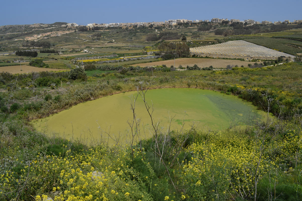
Għajn Damma is a natural pond, located in northern Gozo, between Marsalforn and Xaghra. This pond covers an area of approximately 1,025m2. The pond is accessible through a pathway from a surfaced road. The pond is predominantly surrounded by agricultural land, however, no notable pipelines were seen during the site visit and therefore there remains some uncertainty as whether the si¬¬te is being used for irrigation of those fields. The pond is completely covered by Lemna minor L, whilst within the basin Foeniculum vulgare and Sinapis alba are the dominant species. There is no data present regarding wildlife that frequents this site, however, two White Storks were present within the basin during the site visit. The site is not protected by any legislation.
Wetland data
Basic information
| Wetland location: | Inland |
| Wetland type: | Artificial |
| Wetland area: | 0.10 Ha |
| Hydrological interaction: | - |
| Water salinity: | Fresh (< 0.5 g/l) |
| Type of fresh water input: | Catchment area (precipitation) |
| Surface water runoff | Other |
| Open water area (%): | 26 - 50 |
| Hydroperiod: | Permanent |
Geographic information
| Census district: | Gozo and Comino |
| Island: | Gozo |
| Local council: | Ix-Xaghra |
| Longitude: | 14.257640 East |
| Latitude: | 36.058510 North |
Biological significance
| Biological significance: | Low |
Ramsar wetland type
| Type | Coverage (%) |
| 2 -- Ponds; includes farm ponds, stock ponds, small tanks; (generally below 8 ha) |
Property status
| Private |
Ecosystem services
| Type of ecosystem service | Ecosystem service | Scale of Βenefit (%) | Importance |
| Provisioning services | Food | ||
| Provisioning services | Fresh water | ||
| Regulatory services | Water regulation |
Activities on wetland
| Activity | Intensity |
| 020 = Resource conservation | High |
| 701 = water pollution | High |
| 954 = invasion by a species | High |
Activities on catchment area
| Activity | Intensity |
| 100 = Cultivation | High |
| 110 = Use of pesticides | High |
| 120 = Fertilisation | High |
| 130 = Irrigation | High |
| 502 = roads motorways | Medium |
| 701 = water pollution | High |
Impacts
| Impact | Intensity |
| EE- = Increase of economic potential | High |
| ES- = Increase in water supply | High |
| PF- = Fertilizer/Excess nutrient pollution | High |
| PP- = Pesticide pollution |
Vegetation types
| Type | Coverage (%) |
| Other | 51 - 75 |
| Floating-leaved | > 95 |
Flora
| Species | Presence status | References |
| Foeniculum vulgare | ||
| Lemna minor | ||
| Sinapis alba |
Images
