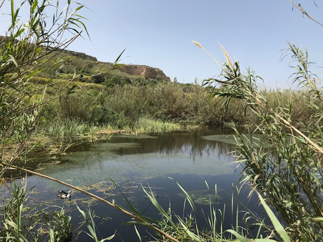
Ta' Ġnien Imrik Pond is a natural pond, located in north-western Gozo, between L-Għarb and Ix-Xagħra. This pond covers an area of approximately 2,190m2. The pond is located on privately-owned land, however, it is still accessible to the public through a dirt road. The pond is predominantly surrounded by agricultural land with numerous pipelines scattered throughout, indicating that the pond is used for the irrigation of these fields. Ranunculus saniculifolius, Lemna minor L. and Typha domingensis are present within the pond whilst the basin is heavily invaded by Arundo donax. The site is not protected by any legislation.
Wetland data
Basic information
Wetland location:
Inland
Wetland type:
Natural
Wetland area:
0.20 Ha
Hydrological interaction:
-
Water salinity:
Fresh (< 0.5 g/l)
Type of fresh water input:
Other
Surface water runoff
Outflow controlled by pipeline
Open water area (%):
76 - 95
Hydroperiod:
Permanent
Geographic information
Census district:
Gozo and Comino
Island:
Gozo
Local council:
Ix-Xaghra
Longitude:
14.257530 East
Latitude:
36.054780 North
Wetland condition
Wetland status (MEDWET):
3 - Original habitats/landform partially modified (10-50% untouched)
Ramsar wetland type
Type
Coverage (%)
Tp -- Permanent freshwater marshes/pools; ponds (below 8 ha), marshes and swamps on inorganic soils; with emergent vegetation water-logged for at least most of the growing season
Property status
Private
Ecosystem services
Type of ecosystem service
Ecosystem service
Scale of Βenefit (%)
Importance
Regulatory services
Flood hazard regulation
Provisioning services
Food
Provisioning services
Fresh water
Cultural services
Recreation and tourism
Regulatory services
Water regulation
Activities on wetland
Activity
Intensity
020 = Resource conservation
High
130 = Irrigation
High
701 = water pollution
High
790 = Other pollution/human impacts/activities
Medium
952 = eutrophication
Low
954 = invasion by a species
Low
Activities on catchment area
Activity
Intensity
100 = Cultivation
High
110 = Use of pesticides
High
120 = Fertilisation
High
130 = Irrigation
High
230 = Hunting
Low
403 = dispersed habitation
Low
502 = roads motorways
High
701 = water pollution
High
954 = invasion by a species
Low
Impacts
Impact
Intensity
EE- = Increase of economic potential
High
ES- = Increase in water supply
High
PF- = Fertilizer/Excess nutrient pollution
High
PP- = Pesticide pollution
Medium
Vegetation types
Type
Coverage (%)
Emergent
51 - 75
Floating-leaved
5 - 25
Flora
Species
Presence status
References
Arundo donax
Lemna minor
Images
Nature Trust Malta. (2019). MtIsWet – Database of the Maltese Islands Wetlands. Updated: 04.2024