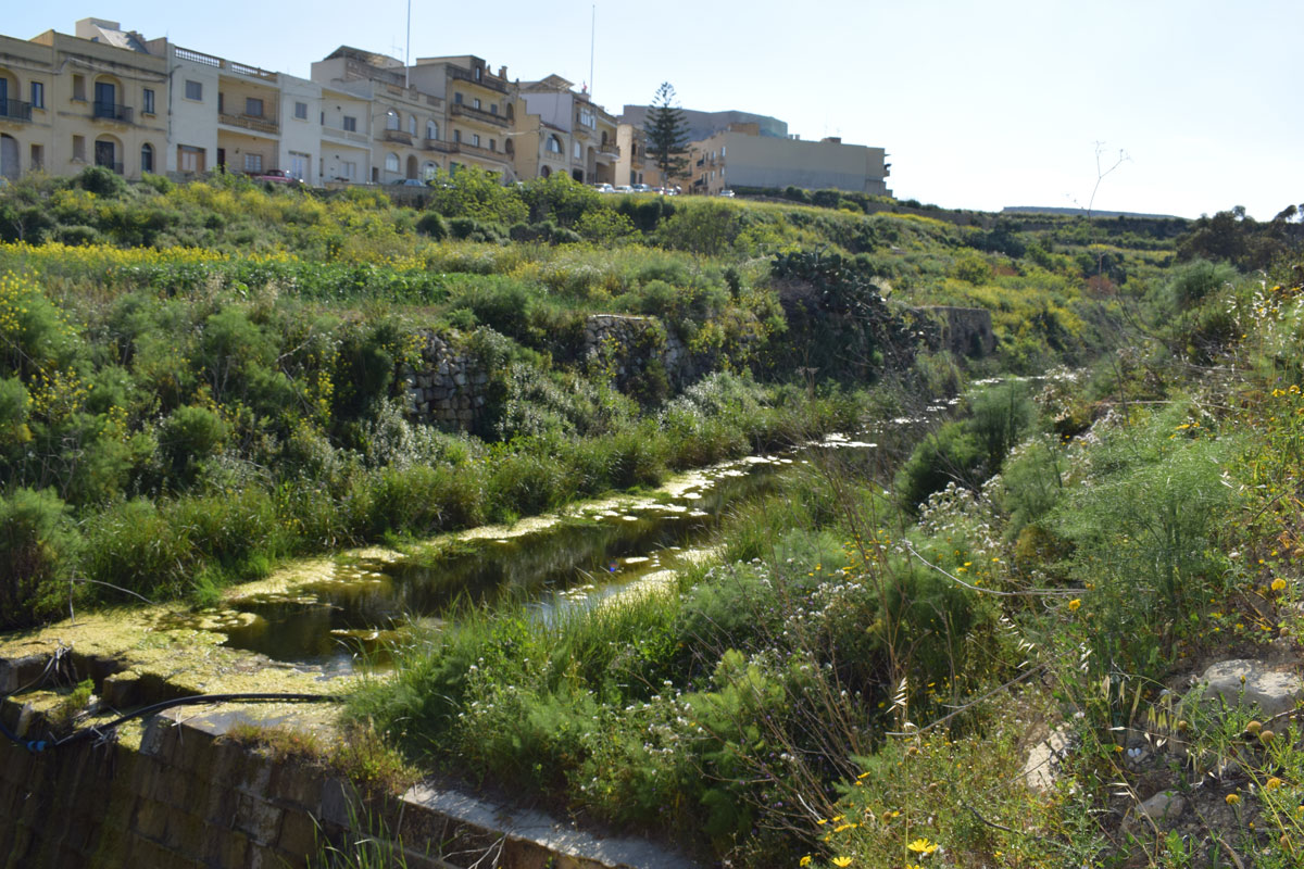
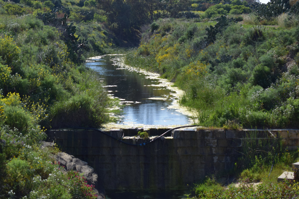
Wied tal-Grazzja is a valley with a single artificially constructed dam, located in central Gozo, within Rabat. The site is not accessible by the public as there are no passageways or footpaths available, however, the dam lake is visible from a nearby surfaced road. The site covers an approximate are of 3,850m2. Due to the site being predominantly surrounded by active agricultural land, it is likely the dam lake is being utilized for irrigation purposes. The site was dominated by Persicaria senegalensis, with Arundo donax, Ricinus communis, Typha domingensis, Galactites tomentosa and Tropaeolum majus L scattered around the basin. The site is not protected by any legislation.
Wetland data
Basic information
Wetland location:
Inland
Wetland type:
Artificial
Wetland area:
0.40 Ha
Hydrological interaction:
Yes
Water salinity:
Fresh (< 0.5 g/l)
Type of fresh water input:
Catchment area (precipitation)
Surface water runoff
Outflow controlled by dam
Open water area (%):
51 - 75
Hydroperiod:
Permanent
Geographic information
Census district:
Gozo and Comino
Island:
Gozo
Local council:
Ir-Rabat, Ghawdex
Longitude:
14.245170 East
Latitude:
36.049740 North
Biological significance
Biological significance:
Low
Ramsar wetland type
Type
Coverage (%)
6 -- Water storage areas; reservoirs/barrages/dams/impoundments (generally over 8 ha)
Property status
Public
Ecosystem services
Type of ecosystem service
Ecosystem service
Scale of Βenefit (%)
Importance
Provisioning services
Fresh water
Regulatory services
Water regulation
Activities on wetland
Activity
Intensity
020 = Resource conservation
Low
130 = Irrigation
High
502 = roads motorways
High
701 = water pollution
High
790 = Other pollution/human impacts/activities
High
910 = Silting up
Medium
952 = eutrophication
High
954 = invasion by a species
High
Activities on catchment area
Activity
Intensity
100 = Cultivation
High
110 = Use of pesticides
High
120 = Fertilisation
High
130 = Irrigation
High
401 = continuous urbanisation
Medium
430 = Agricultural structures
Low
502 = roads motorways
High
701 = water pollution
High
790 = Other pollution/human impacts/activities
High
Impacts
Impact
Intensity
EE- = Increase of economic potential
Low
ER- = Increase in flow regulation
High
ES- = Increase in water supply
High
PF- = Fertilizer/Excess nutrient pollution
High
PO- = Oil pollution
High
PP- = Pesticide pollution
Medium
PU- = Increase of turbidity
High
Vegetation types
Type
Coverage (%)
Emergent
51 - 75
Other
26 - 50
Wet meadow
26 - 50
Flora
Species
Presence status
References
Arundo donax
Galactites tomentosa
Persicaria senegalensis
Ricinus communis
Tropaeolum majus
Typha domingensis
Images
Nature Trust Malta. (2019). MtIsWet – Database of the Maltese Islands Wetlands. Updated: 05.2024