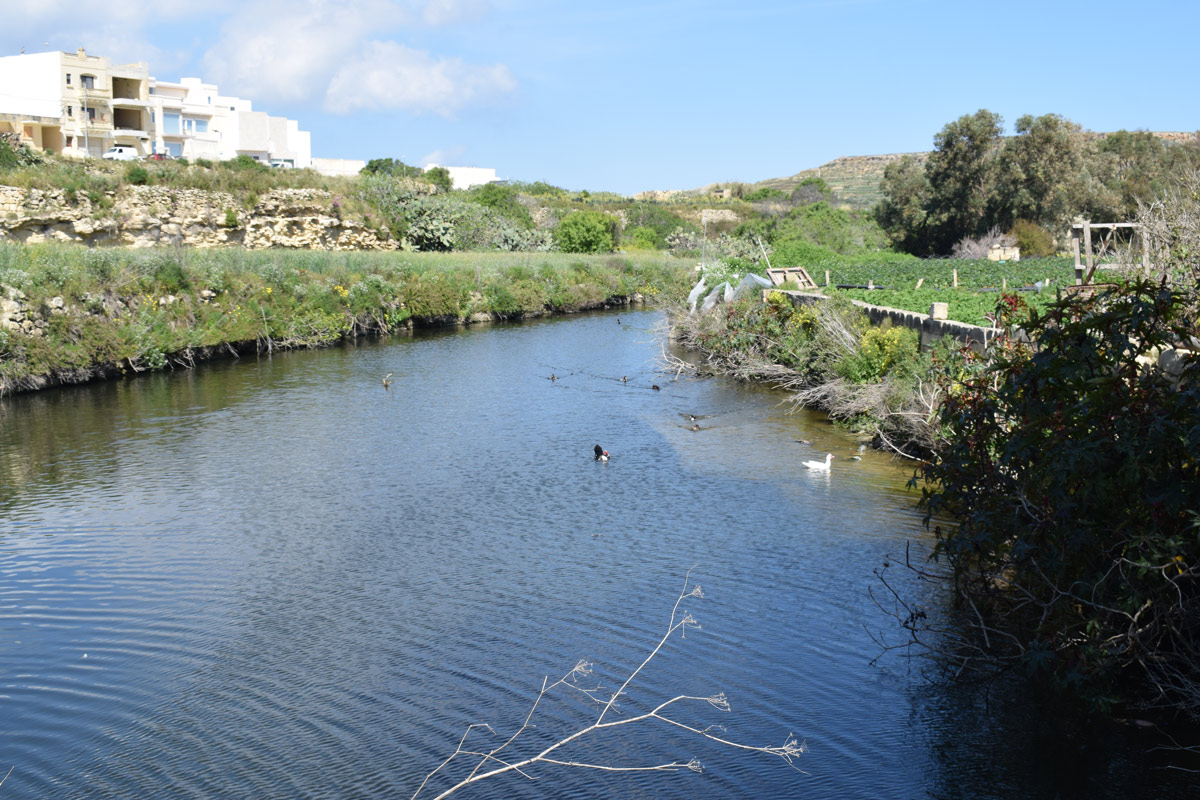
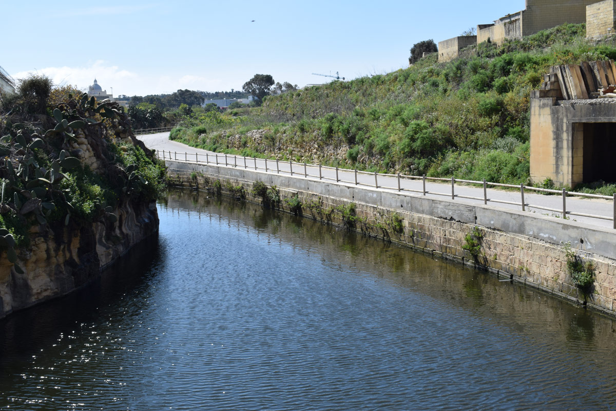
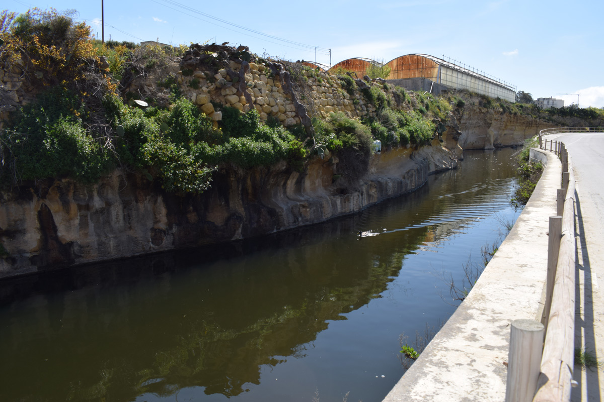
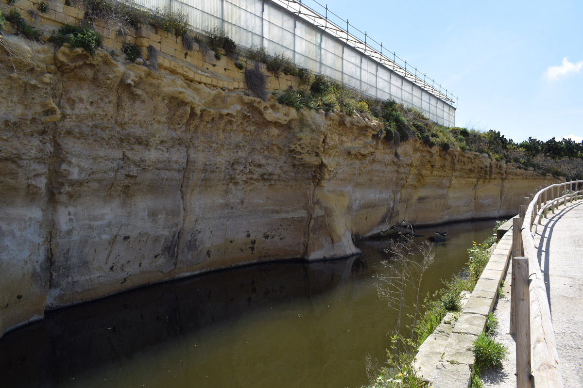
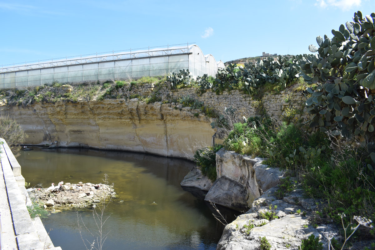
Tas-Sellum Watercourse are two interconnected dam lakes, located in central Gozo, within Rabat. The site is accessible by the public through a footpath and surfaced road. The dam lakes cover an approximate area of 3,220m2. The northern region of the dam lakes is surrounded by active agricultural land, whilst the southern region lies alongside a surfaced road on the western basin, and agricultural land on the eastern basin. Eucalpytus spp. was present towards the north-eastern region of the dam lake. This site is not protected by any legislation.
Wetland data
Basic information
Wetland location:
Inland
Wetland type:
Artificial
Wetland area:
0.30 Ha
Hydrological interaction:
Yes
Water salinity:
Fresh (< 0.5 g/l)
Type of fresh water input:
Catchment area (precipitation)
Surface water runoff
Outflow controlled by pipeline
Open water area (%):
> 95
Hydroperiod:
Permanent
Geographic information
Census district:
Gozo and Comino
Island:
Gozo
Local council:
Ir-Rabat, Ghawdex
Longitude:
14.250270 East
Latitude:
36.044850 North
Biological significance
Biological significance:
Low
Ramsar wetland type
Type
Coverage (%)
6 -- Water storage areas; reservoirs/barrages/dams/impoundments (generally over 8 ha)
Property status
Public
Ecosystem services
Type of ecosystem service
Ecosystem service
Scale of Βenefit (%)
Importance
Regulatory services
Flood hazard regulation
Provisioning services
Fresh water
Regulatory services
Storm hazard regulation
Regulatory services
Water regulation
Activities on wetland
Activity
Intensity
020 = Resource conservation
High
130 = Irrigation
High
502 = roads motorways
High
701 = water pollution
High
790 = Other pollution/human impacts/activities
Low
Activities on catchment area
Activity
Intensity
100 = Cultivation
High
110 = Use of pesticides
High
120 = Fertilisation
High
130 = Irrigation
High
402 = discontinuous urbanisation
Low
430 = Agricultural structures
High
502 = roads motorways
High
790 = Other pollution/human impacts/activities
Low
Impacts
Impact
Intensity
EB- = Increase in aesthetic qualities
High
EE- = Increase of economic potential
High
EF- = Increase in protection from natural forces
High
ER- = Increase in flow regulation
High
ES- = Increase in water supply
Low
PF- = Fertilizer/Excess nutrient pollution
PH- = Increase of pH
PP- = Pesticide pollution
Vegetation types
Type
Coverage (%)
Shrubby / Arborescent
< 5
Flora
Species
Presence status
References
Eucalyptus sp.
Images
Nature Trust Malta. (2019). MtIsWet – Database of the Maltese Islands Wetlands. Updated: 04.2024