GOZ025 - Tan-Nuffara
Description
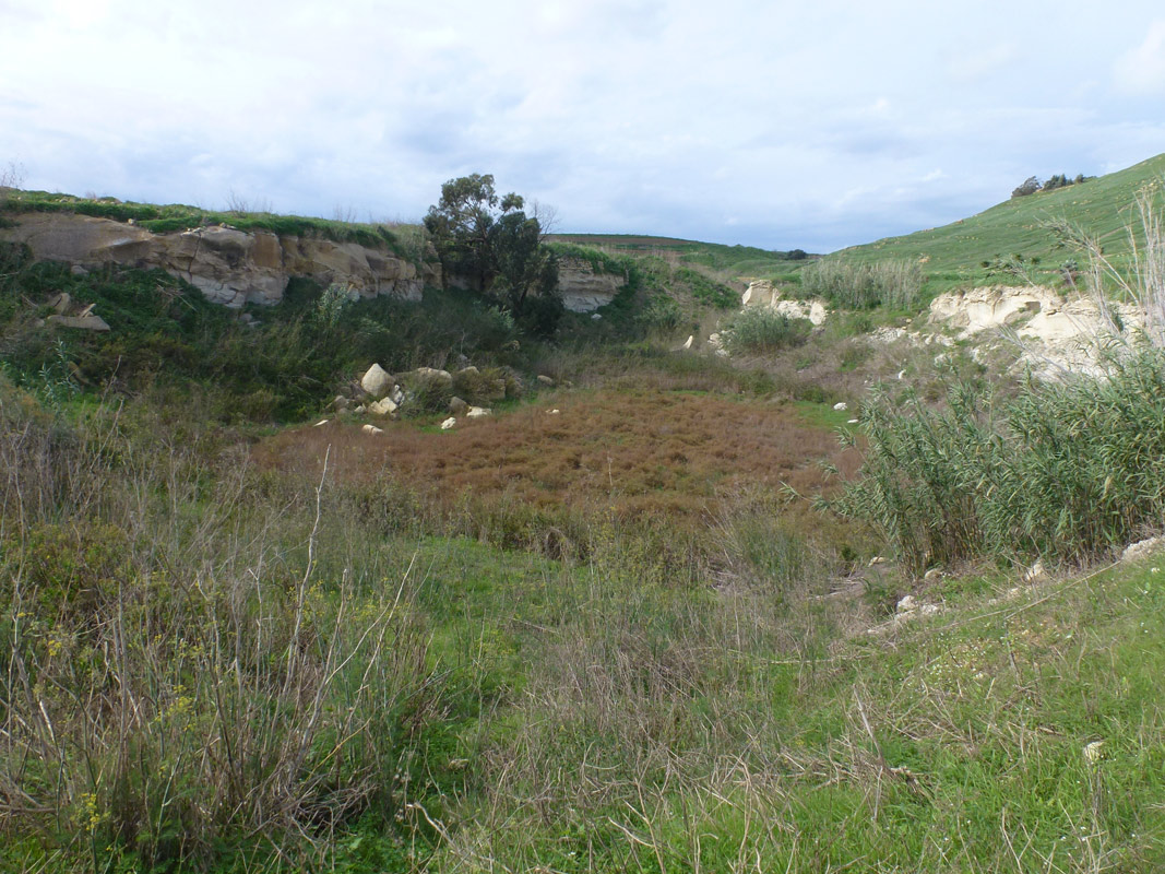
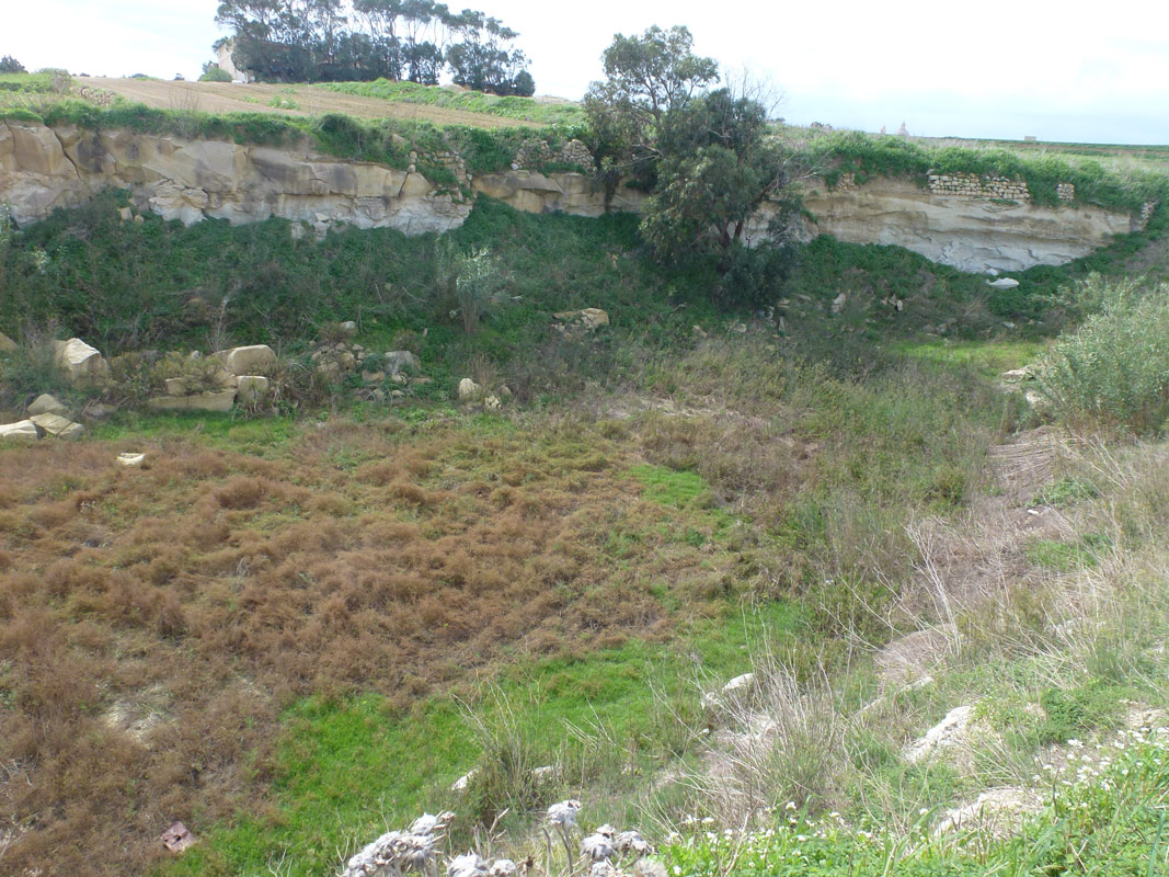
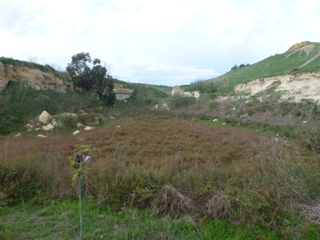
Tan-Nuffara is a semi-natural pond, located in northern Gozo, between Marsalforn and Xagħra. The pond covers an area of approximately 2,696 m2 and is accessible through a pathway from a surfaced road. The area retains water due to being located behind a dam. The northern region of the pond consists predominantly of abandoned agricultural land and a couple of active agricultural land in the southern and eastern region of the pond. It is likely that the water collected is being utilised for irrigation purposes due to the emerging pipelines emerging from nearby agricultural land. The site is dominated by opportunistic species including Ferula communis and Dittrichia viscosa, Riparian species including Arundo donax, Phragmites australis, and Rumex conglomeratus and a large population of Lepidium graminifolium. A couple of Eucalptus trees are also present within the basin of the site. The site falls within a No Trapping Zone under legislation S.L. 504.71.
Wetland data
Basic information
| Wetland location: | Inland |
| Wetland type: | Artificial |
| Wetland area: | 0.30 Ha |
| Hydrological interaction: | Yes |
| Water salinity: | Fresh (< 0.5 g/l) |
| Type of fresh water input: | Torrent / Stream - Unconfined aquifer |
| Surface water runoff | There is no obvious water outflow |
| Open water area (%): | 26 - 50 |
| Hydroperiod: | Seasonal |
Geographic information
| Census district: | Gozo and Comino |
| Island: | Gozo |
| Local council: | Ix-Xewkija |
| Longitude: | 14.275640 East |
| Latitude: | 36.038620 North |
Biological significance
| Biological significance: | Low |
Ramsar wetland type
| Type | Coverage (%) |
| 2 -- Ponds; includes farm ponds, stock ponds, small tanks; (generally below 8 ha) |
Property status
| Public |
Ecosystem services
| Type of ecosystem service | Ecosystem service | Scale of Βenefit (%) | Importance |
| Provisioning services | Fresh water | ||
| Supporting services | Provision of habitat | ||
| Cultural services | Recreation and tourism | ||
| Regulatory services | Water regulation |
Activities on wetland
| Activity | Intensity |
| 230 = Hunting | High |
| 424 = other discharges | Low |
| 700 = Pollution | Medium |
| 852 = modifying structures of inland water courses | High |
| 900 = Erosion | Medium |
| 910 = Silting up | Medium |
Activities on catchment area
| Activity | Intensity |
| 100 = Cultivation | Medium |
| 110 = Use of pesticides | High |
| 120 = Fertilisation | High |
| 230 = Hunting | High |
| 412 = industrial stockage | Medium |
| 423 = disposal of inert materials | Medium |
| 502 = roads motorways | Low |
| 623 = motorised vehicles | High |
| 852 = modifying structures of inland water courses | High |
| 900 = Erosion | High |
Impacts
| Impact | Intensity |
| EE- = Increase of economic potential | High |
| ES- = Increase in water supply | Low |
| PF- = Fertilizer/Excess nutrient pollution | Medium |
| PP- = Pesticide pollution | High |
Vegetation types
| Type | Coverage (%) |
| Emergent | < 5 |
| Shrubby / Arborescent | < 5 |
| Other | 51 - 75 |
| Shrubby / Arborescent |
Flora
| Species | Presence status | References |
| Arundo donax | ||
| Dittrichia viscosa | ||
| Eucalyptus sp. | ||
| Ferula communis | ||
| Lepidium graminifolium | ||
| Phragmites australis | ||
| Rumex conglomeratus |
Images