MAL003 - L-Ghadira z-Zghira
Description
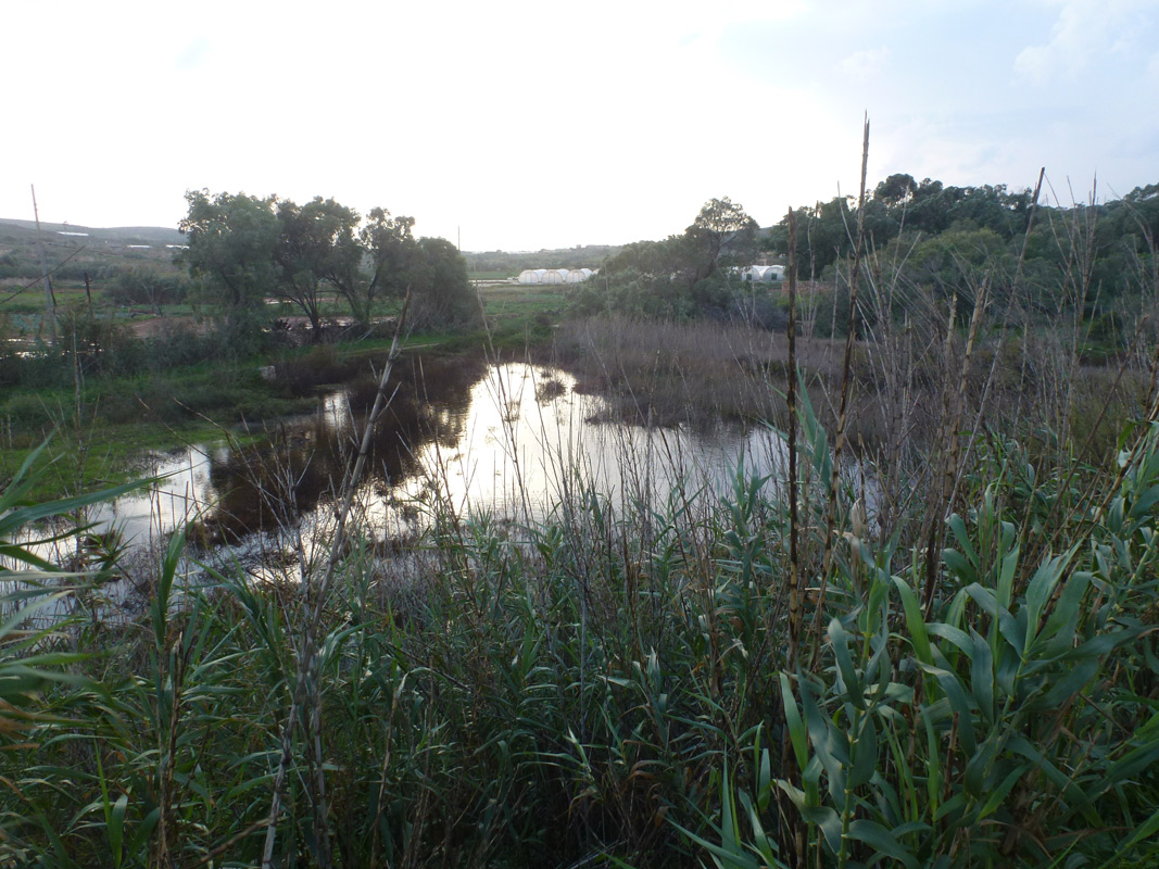
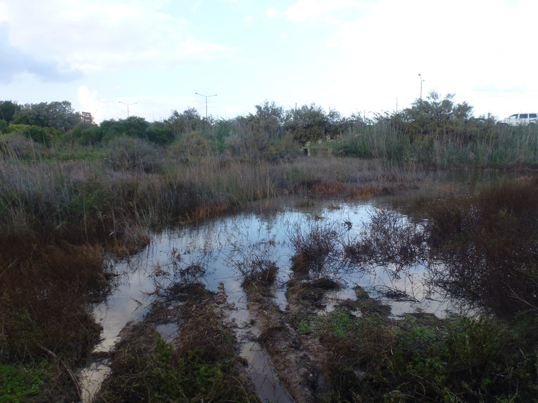
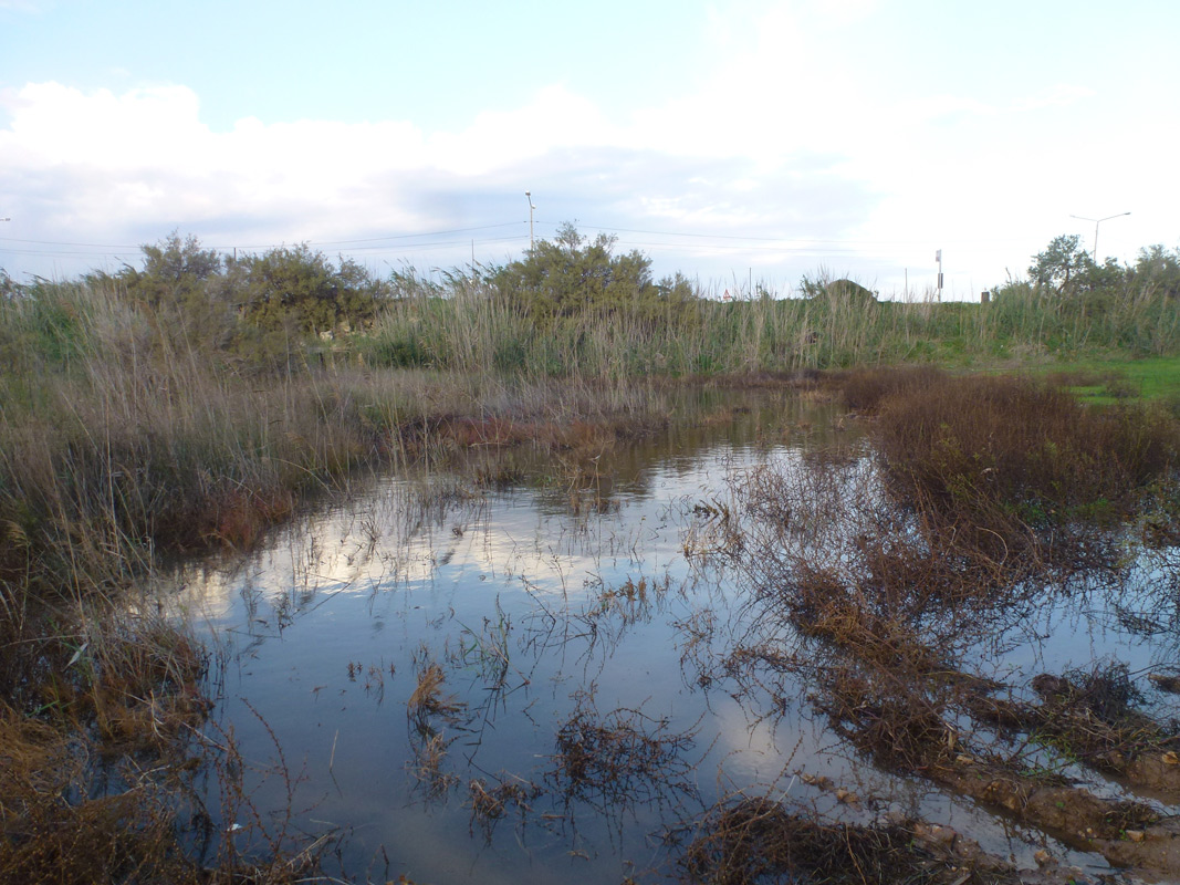
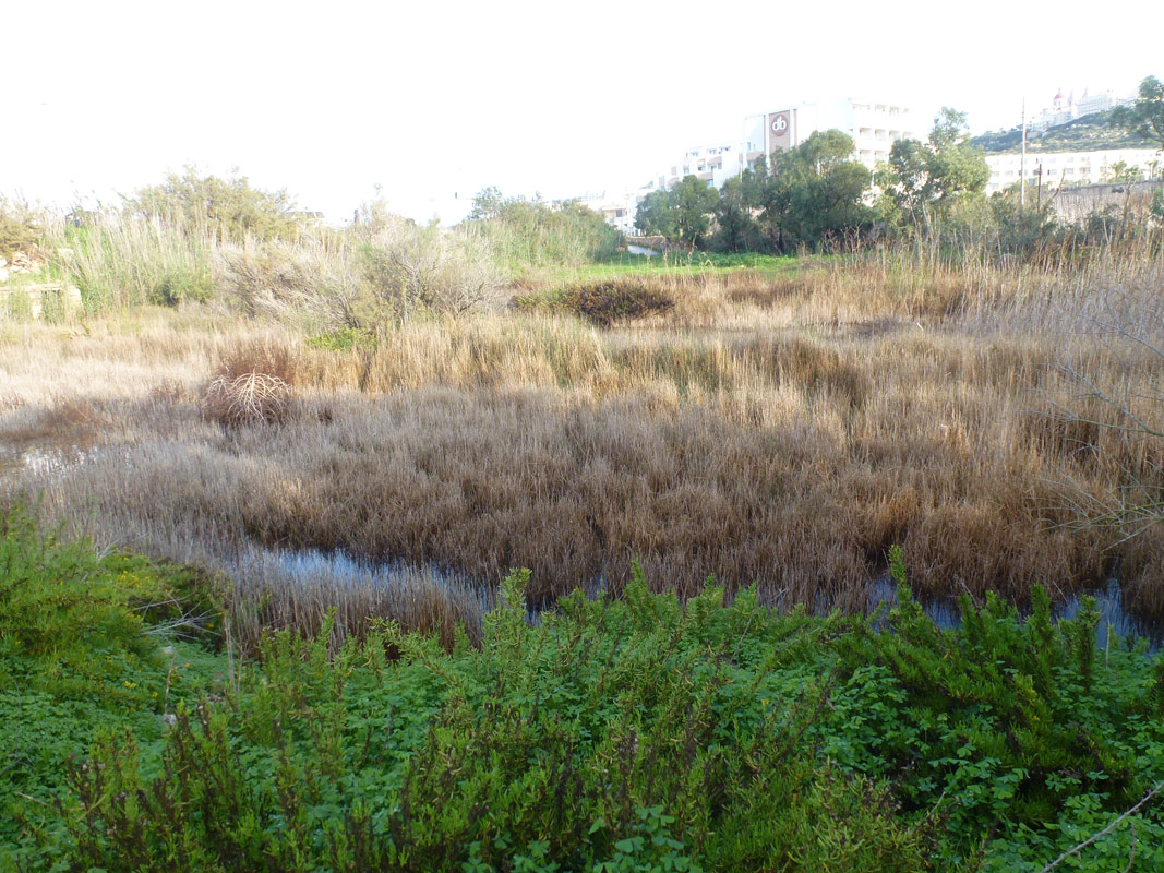
This marshland is found in the southeastern corner of L-Għadira Natura 2000 site, is triangular in shape and is bordered to the south by a road used by farmers to access agricultural land located to the south of the marshland. The western boundary of the marshland is demarcated by the boundary wall of the Mellieha Holiday Complex. The northeastern boundary of the marshland is flanked by the arterial road. Thus, the marshland, in its current state is surrounded by anthropogenic influences. Il-Ħofra saline marshland is included within the same Natura 2000 site as MAL001 (L-Għadira). Il-Ħofra saline marshland is a Level 1 Area of Ecological Importance. The marshland is surrounded by a buffer Level 3 Area of Ecological Importance. Il-Ħofra is characterised by a muddy substratum on which a pool of brackish water collects in the wet season. The marshland is maintained by seasonal fluctuations in precipitation, run-off, evaporation, and groundwater seepage. Coastal tidal fluctuations have an insignificant control. During the dry season the water in the saline marshland becomes progressively brackish until it becomes hyper saline and finally dries out completely until the following wet season. The ecosystem at the marshland depends significantly on groundwater from the Mellieha coastal aquifer. Run-off from a series of valleys dissecting the northern side of the Mellieha Ridge also feeds the marshland. The marshland receives run-off from Wied Ingraw, Wied il-Ħanżira, Wied il-Ħalqun, and Wied ta’ Randa. Run-off from il-Bisqra also reaches Il-Ħofra marshland.The marshland is relatively degraded. The central marshland area is characterised by typical marshland species, namely Juncus subulatus, Juncus acutus, and Phragmites australis. These species grow around a depression where water collects. Dried Salicornia ramosissima and Suaeda maritima were recorded growing in the depression. The marshland area (dominated by Juncus subulatus) creates a boundary around a central area that includes Tamarix sp trees and a more disturbed area dominated by Dittrichia viscosa and Foeniculum vulgare. Single specimens of Urginea pancration and Anthyllis hermanniae were recorded in this area. Specimens of Juncus acutus also grow within this area. A number of species typical of coastal, salty habitats were recorded including Aetheorhiza bulbosa, Lotus cytisoides, Atriplex prostata, and Parapholis filiformis. Other species recorded include, Evidence of disturbance to the site included dumped material and the presence of species such as Cynodon dactylon, Oxalis pes-caprae, Dittrichia viscosa, Galium murale, Lagurus ovatus, and Foeniculum vulgare. Inula crithmoides and Beta maritima also grow within the marshland. The marshland is further disturbed as a result of its interruption by the arterial road running along its northern boundary. The northern edge of the site includes mounds of material, presumably resulting from the construction of the road embankment. This area is dominated by Arundo donax. Several Acacia saligna trees grow closer to the western boundary of the marshland (close to the Mellieha Holiday Complex boundary wall). The westernmost area of the marshland (boundary with the Mellieha Holiday Complex) includes species typical of degraded habitats and segetal species.This wetland once supported a significant population of Carex extensa which is listed in the Red Data Book (RDB) as an Endangered Species with a restricted distribution in the Maltese Islands. Threats to Il-Ħofra include: •Disturbance of the watercourses that supply it with freshwater; •Pollution related to agricultural activities in the neighbouring areas; and •Trampling from cars associated with the urbanisation of the area especially in summer months. Degradation of the marshland is also attested to artificial planting, mostly of Acacia saligna and Arundo donax, which was carried out around the Għadira wetland, following the re-engineering works.
Wetland data
Basic information
| Wetland location: | Marine/Coastal |
| Wetland type: | Natural |
| Wetland area: | 0.80 Ha |
| Hydrological interaction: | - |
| Water salinity: | Brackish (5.0-18.0 g/l) |
| Type of fresh water input: | Catchment area (precipitation) |
| Surface water runoff | There is no obvious water outflow |
| Open water area (%): | 5 - 25 |
| Hydroperiod: | Permanent |
Geographic information
| Census district: | Northern |
| Island: | Malta |
| Local council: | Il-Mellieha |
| Longitude: | 14.352040 East |
| Latitude: | 35.966180 North |
Wetland condition
| Wetland status (MEDWET): | 3 - Original habitats/landform partially modified (10-50% untouched) |
Ramsar wetland type
| Type | Coverage (%) |
| H -- Intertidal marshes; includes salt marshes, salt meadows, saltings, raised salt marshes; includes tidal brackish and freshwater marshes |
Property status
| Public |
| Protection status category | Protection status subcategory | Area's name | Code | Coverage area (%) | Legislation |
| National | Area of Ecological Importance | Bur salmastru fil-Hofra (l/tal-Mellieha) | 174740 | 100 | Development Planning Act (Act VII of 2016) |
| National | Bird Sanctuary | Il-madwar ta' l-Ghadira, fil-Bajja tal-Mellieha | 11704 | 89 | Environment Protection Act (Act I of 2016) |
| International | Special Areas of Conservation - International Importance | L-Inhawi ta' l-Ghadira | 330721 | 100 | Environment Protection Act (Act I of 2016) |
| International | Special Protection Areas | L-Inhawi ta' l-Ghadira | 555552404 | 100 | Environment Protection Act (Act I of 2016) |
CDDA protection status
| CDDA code | CDDA category |
| MT01 | Area of Ecological Importance |
| MT03 | Bird Sanctuary |
| MT11 | Special Areas of Conservation - International Importance |
| MT13 | Special Protection Areas |
Ecosystem services
| Type of ecosystem service | Ecosystem service | Scale of Βenefit (%) | Importance |
| Supporting services | Provision of habitat | ||
| Regulatory services | Storm hazard regulation | ||
| Regulatory services | Water regulation |
Activities on wetland
| Activity | Intensity |
| 010 = Habitat conservation | High |
| 423 = disposal of inert materials | High |
| 701 = water pollution | High |
| 954 = invasion by a species | High |
Activities on catchment area
| Activity | Intensity |
| 100 = Cultivation | High |
| 110 = Use of pesticides | High |
| 120 = Fertilisation | High |
| 130 = Irrigation | High |
| 402 = discontinuous urbanisation | High |
| 430 = Agricultural structures | Medium |
| 501 = paths tracks cycling tracks | High |
| 502 = roads motorways | High |
| 701 = water pollution | High |
| 810 = Drainage | High |
| 830 = Canalisation | High |
Impacts
| Impact | Intensity |
| EW- = Increase in wilderness/wildlife values | High |
| HF- = Habitat fragmentation | High |
| HL- = Habitat loss | High |
| PF- = Fertilizer/Excess nutrient pollution | High |
| PP- = Pesticide pollution | |
| VC- = Change in vegetative species composition | |
| VCX = Introduction of exotic floral species | |
| VP- = Decrease in population of floral species | |
| VS- = Change in vegetative structure |
Habitat types
| Type | Coverage (%) |
| 1410 Mediterranean salt meadows (Juncetalia maritimi) | 26 - 50 |
| 92D0 Southern riparian galleries and thickets (Nerio-Tamaricetea and Securinegion tinctoriae) | 26 - 50 |
Vegetation types
| Type | Coverage (%) |
| Shrubby / Arborescent | 26 - 50 |
| Ammophilous | |
| Other | |
| Emergent | 5 - 25 |
| Halophytic | |
| Wet meadow | 26 - 50 |
Flora
| Species | Presence status | References |
| Acacia saligna | ||
| Aetheorhiza bulbosa | ||
| Anthyllis hermanniae subsp. melitensis | ||
| Antirrhinum siculum | ||
| Arundo donax | ||
| Atriplex prostrata | ||
| Beta vulgare subsp. Maritima | ||
| Chasmanthe bicolor | ||
| Conyza bonariensis | ||
| Cynodon dactylon | ||
| Diplotaxis erucoides | ||
| Diplotaxis tenuifloia | ||
| Dittrichia viscosa | ||
| Erodium moschatum | ||
| Euphorbia pinea | ||
| Foeniculum vulgare | ||
| Galium murale | ||
| Glebionis coronaria | ||
| Jacobaea crithmoides | ||
| Juncus acutus | ||
| Juncus subulatus | ||
| Lagurus ovatus | ||
| Lotus cytisoides | ||
| Mercurialis annua | ||
| Oxalis pes-caprae | ||
| Parapholis filiformis | ||
| Phoenix canariensis | ||
| Salicornia ramosissima | ||
| Suaeda maritima | ||
| Tamarix africana | ||
| Urginea pancration |
Fauna
| Mammals | Presence status in wetland | References | |
| Mustela nivalis (L., 1766) | |||
| Myotis punicus (Felten, 1977) | |||
| Nyctalus noctula (Schreber, 1774) | |||
| Pipistrellus kuhlii (Kuhl, 1817) | |||
| Pipistrellus pipistrellus (Schreber, 1774) | |||
| Plecotus austriacus (Fischer, 1829) | |||
| Rhinolophus hipposideros (Bechstein, 1800) | |||
| Suncus etruscus (Savi, 1822) | |||
Birds |
Number of individuals |
Nesting |
References |
| Calidris alpina (Linnaeus, 1758) | |||
| Calidris minuta (Leisler, 1812) | |||
| Ardeola ralloides (Scopoli, 1769) | |||
| Ixobrychus minutus (Linnaeus, 1766) | |||
| Acrocephalus schoenobaenus (Linnaeus, 1758) | |||
| Cisticola juncidis (Rafinesque, 1810) | |||
| Emberiza calandra (Linnaeus, 1758) | |||
| Erithacus rubecula (Linnaeus, 1758) | |||
| Passer hispaniolensis (Temminck, 1820) | |||
| Phylloscopus collybita (Vieillot, 1817) | |||
| Phylloscopus sibilatrix (Bechstein, 1793) | |||
| Phylloscopus trochilus (Linnaeus, 1758) | |||
| Saxicola rubetra (Linnaeus, 1758) | |||
| Sylvia communis (Latham, 1787) | |||
| Sylvia melanocephala (J.F. Gmelin, 1789) | |||
| Tachybaptus ruficollis (Pallas, 1764) | |||
Reptiles |
Presence status in wetland |
References |
|
| Chalcides ocellatus tiligugu (Gmelin, 1789) | |||
| Chamaeleo chamaeleon (Linnaeus, 1758) | |||
| Coluber viridiflavus carbonarius (Bonaparte, 1833) | |||
| Hemidactylus turcicus (Arnold, 1980) | |||
| Podarcis filfolensis maltensis (Mertens, 1921) | |||
| Tarentola mauritanica (Linnaeaus, 1758) | |||
| Telescopus fallax (Fleischmann, 1831) | |||
| Zamenis situla (Linnaeus, 1758) | |||
Invertebrates |
Presence status in wetland |
References |
|
| Tetragnatha extensa (Linnaeus, 1758) | |||
| Anthicus fenestratus (W.L.E. Schmidt, 1842) | |||
| Cyclodinus humilis (Germar, 1824) | |||
| Cyclodinus minutus (La Ferté-Sénectère, 1842) | |||
| Leptaleus rodriguesi (Latreille, 1804) | |||
| Anoxia australis (Gyllenhal, 1817) | |||
| Scarabeus semipunctatus (Fabricius, 1792) | |||
| Allophylax picipes melitensis (Baudi de Selve, 1876) | |||
| Ammobius rufus (Lucas, 1849) | |||
| Erodius siculus melitensis (Reitter, 1914) | |||
| Pseudoseriscius cameroni (Reitter, 1902) | |||
| Stenosis melitana (Reitter, 1894) | |||
| Stenosis schembrii (Canzoneri, 1979) | |||
| Protrama baronii | |||
| Philanthus raptor siculus (Giordani Soika, 1944) | |||
| Smicromyrme n.sp.(?) | |||
| Tachyagetyes n.sp. (?) | |||
| Prionyx viduatus (Christ, 1791) | |||
| Coleophora mellechella (Toll, 1962) | |||
| Brachytrupes megacephalus (Lefèvre, 1827) | |||
| Odontura stenoxipha (Fieber, 1853) | |||
| Gammarus aequicauda (Martynov, 1931) |
Adi Associates Environmental Consultants Ltd (2004) Mellieħa Bay: Regional Environmental Assessment.
Adi Associates Environmental Consultants Ltd (2009) Existing to existing Seabank Hotel and extension of facilities, Triq il-Marfa – Mellieħa: Environmental Impact Statement
Adi Epsilon Consortium (2014f) L-Inhawi tal-Ghadira – Natura 2000 Management Plan (SAC). Prepared for the Malta Environment and Planning Authority under CT3101/2011. San Gwann, Malta, pp. 112 + Annex
Images