MAL007 - Il-Migduma
Description
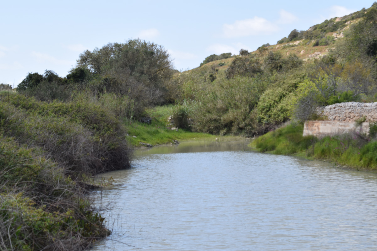
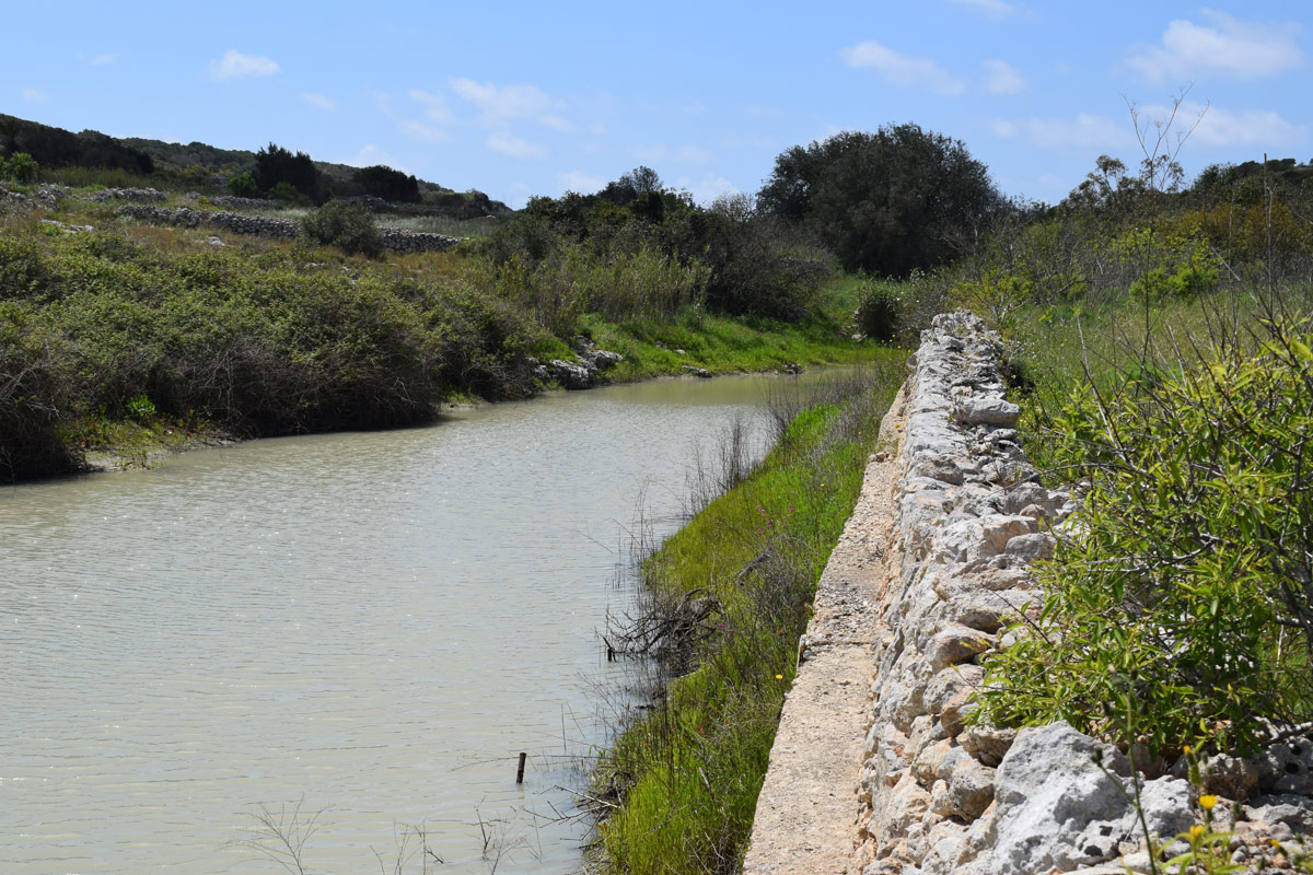
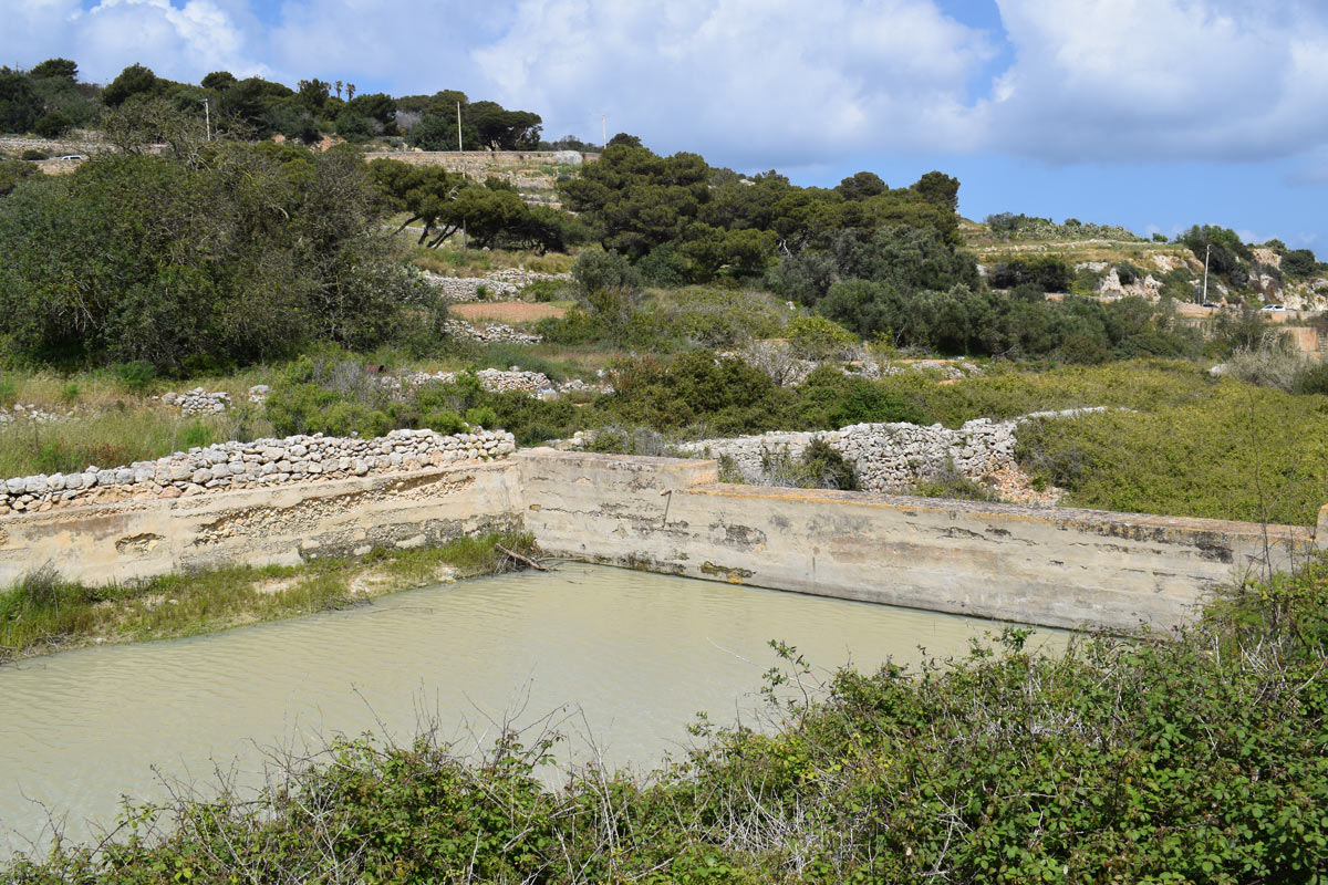
Il-Migduma is an artificial dam lake, located in Northern Malta, within Xemxija. The site is easily accessible by the public through a pathway. The dam lake covers an area of approximately 2,011m2. The site is predominantly surrounded by garigue habitat whilst northern region of the artificial dam lake consists of active agricultural land. It is likely that the water collected is being utilised for irrigation purposes due to numerous pipelines within the reservoir. The perimeter of the site was surrounded by different species including, Medicago orbicularis, Prasium majus, Anagallis arvensis, Sedum caeruleum and Erica multiflora. The site makes part Wied il-Mistra watercourse and is not protected by any legislation.

Wetland data
Basic information
| Wetland location: | Inland |
| Wetland type: | Artificial |
| Wetland area: | 0.20 Ha |
| Hydrological interaction: | - |
| Water salinity: | Fresh (< 0.5 g/l) |
| Type of fresh water input: | Catchment area (precipitation) |
| Surface water runoff | Other |
| Open water area (%): | > 95 |
| Hydroperiod: | Permanent |
Geographic information
| Census district: | Northern |
| Island: | Malta |
| Local council: | Il-Mellieha |
| Longitude: | 14.378830 East |
| Latitude: | 35.952130 North |
Biological significance
| Biological significance: | Low |
Ramsar wetland type
| Type | Coverage (%) |
| 6 -- Water storage areas; reservoirs/barrages/dams/impoundments (generally over 8 ha) |
Property status
| Public |
Ecosystem services
| Type of ecosystem service | Ecosystem service | Scale of Βenefit (%) | Importance |
| Regulatory services | Flood hazard regulation | ||
| Provisioning services | Food | ||
| Provisioning services | Fresh water | ||
| Regulatory services | Water regulation |
Activities on wetland
| Activity | Intensity |
| 020 = Resource conservation | High |
| 110 = Use of pesticides | High |
| 120 = Fertilisation | High |
| 701 = water pollution | High |
| 910 = Silting up | Medium |
Activities on catchment area
| Activity | Intensity |
| 100 = Cultivation | High |
| 110 = Use of pesticides | High |
| 120 = Fertilisation | High |
| 130 = Irrigation | High |
| 502 = roads motorways | Medium |
| 701 = water pollution | High |
| 954 = invasion by a species | High |
Impacts
| Impact | Intensity |
| EE- = Increase of economic potential | High |
| ER- = Increase in flow regulation | High |
| ES- = Increase in water supply | High |
| PF- = Fertilizer/Excess nutrient pollution | High |
| PP- = Pesticide pollution | Medium |
| PU- = Increase of turbidity |
Vegetation types
| Type | Coverage (%) |
| Emergent | 5 - 25 |
| Other | 26 - 50 |
| Shrubby / Arborescent | 5 - 25 |
Flora
| Species | Presence status | References |
| Anagallis arvensis | ||
| Erica multiflora | ||
| Medicago orbicularis | ||
| Prasium majus | ||
| Sedum caeruleum |
Images