MAL019 - Wied Qannotta
Description
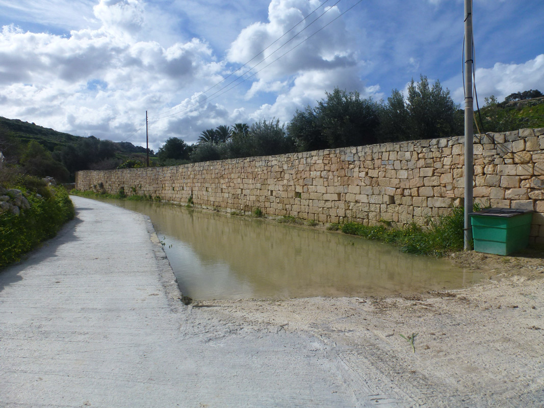
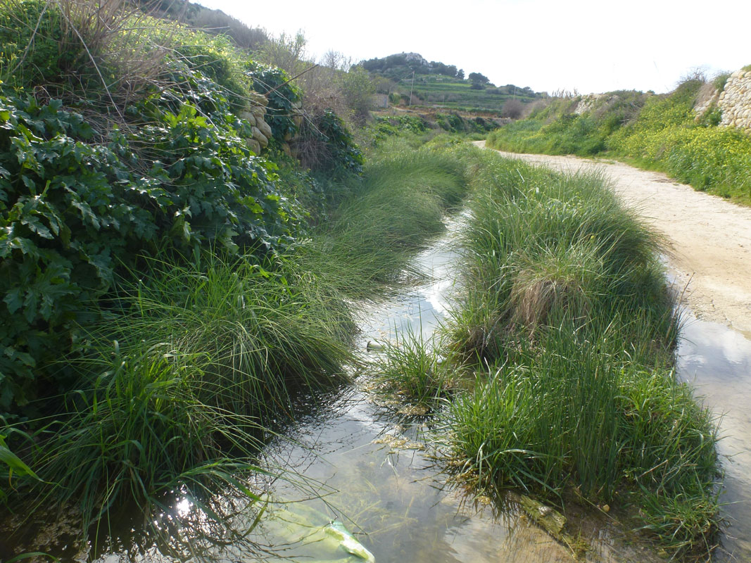
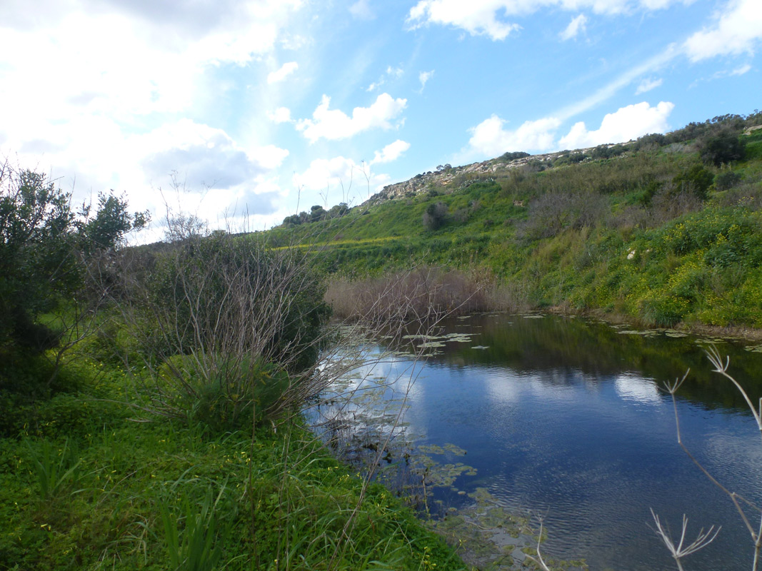
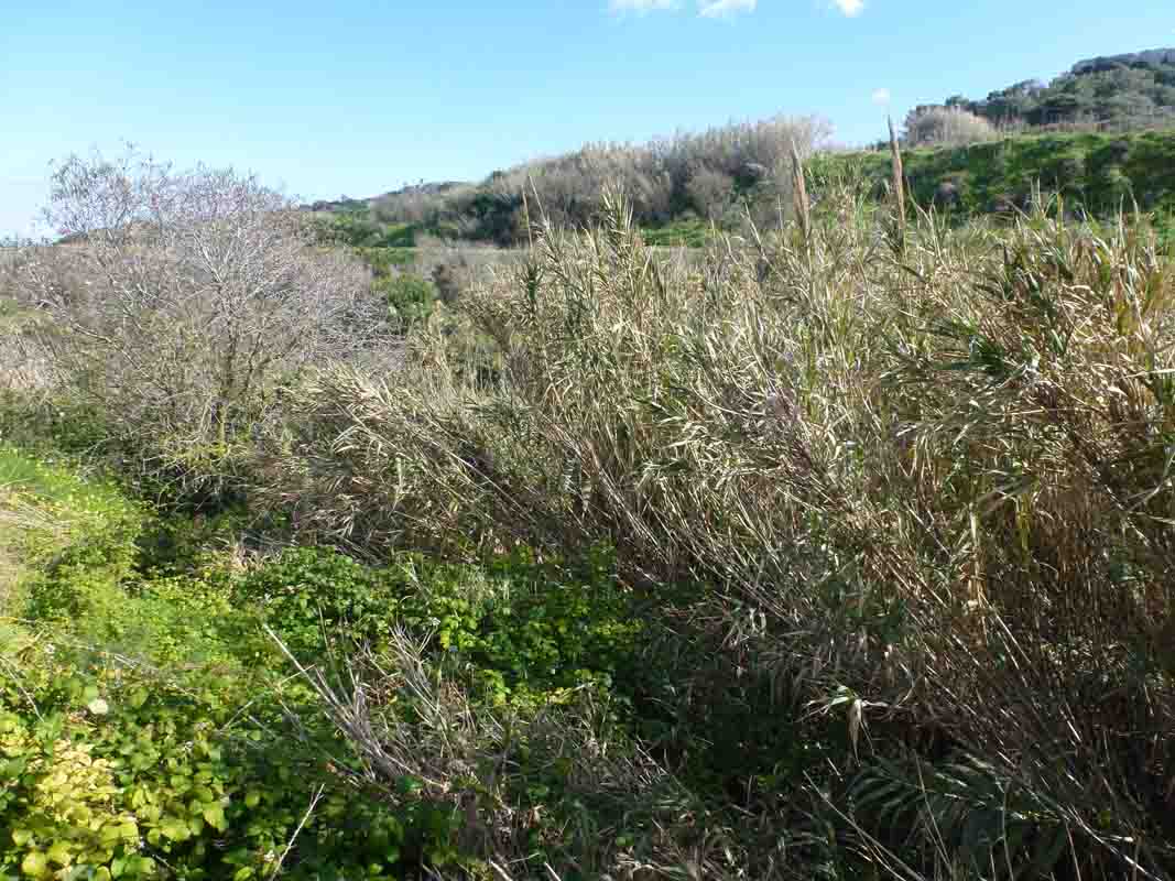
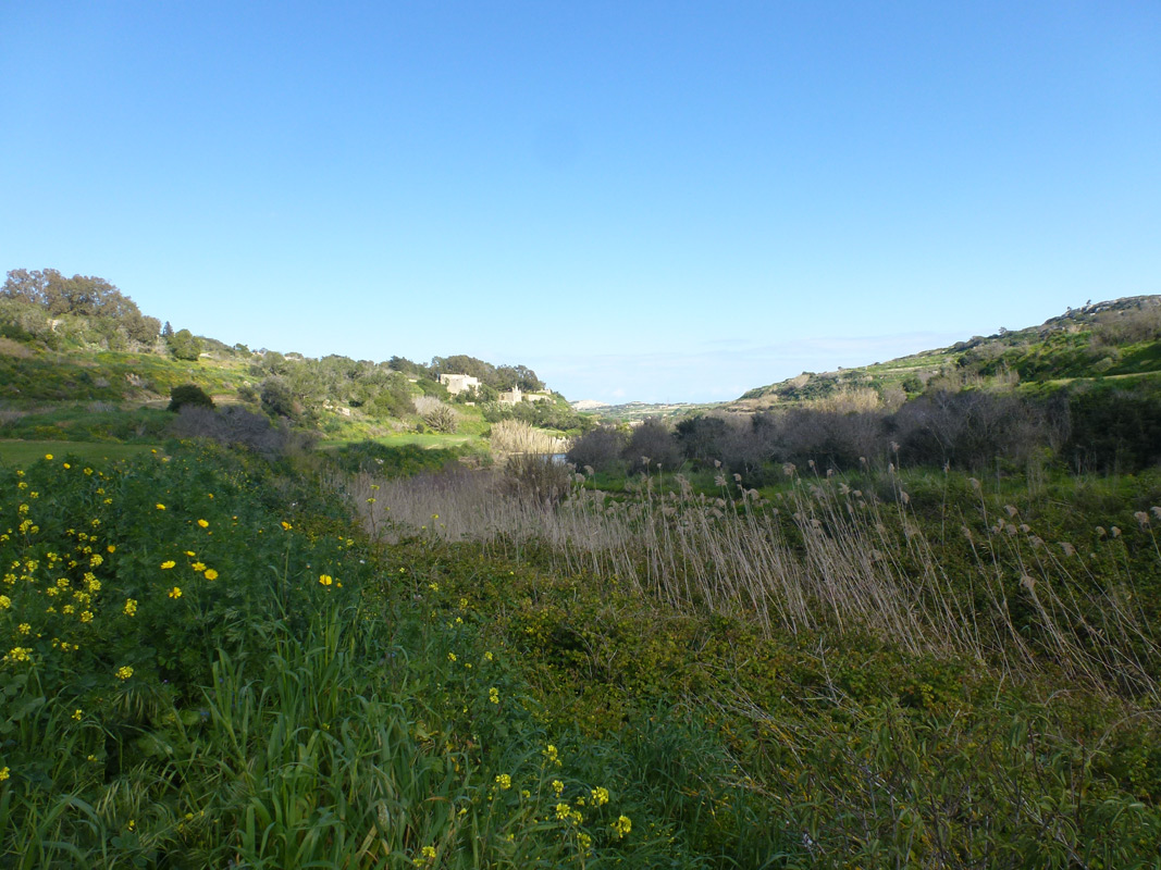
Wied Qannotta is a tributary of the Wied il-Ghasel system, located in northern Malta, within the limits of Saint Pauls Bay. Throughout the valley there are two separate dams, however only one of them stores water as the other had been damaged during the October 1979 floods. The valley is accessible by an unsurfaced road. The site covers an approximate area of 3,880m2. The site is predominantly surrounded by agricultural land with pipelines scattered throughout indicating the site is still being used for irrigation purposes. Several watercourse species had been noted including Scirpoides holoschoenus, bolboschoenus maritimus, Rumex conglomeratus and Lythrum junceum. Further along the watercourse, at higher terrain, the vegetation along the valley sides and within the valley included typical valley and maquis species including Rubus ulmifolius, Prunus dulcis, Rhamnus sp. At the northern-end of the site, a reedbed of Phragmites australis was dominating the area.

Wetland data
Basic information
| Wetland location: | Inland |
| Wetland type: | Artificial |
| Wetland area: | 0.40 Ha |
| Hydrological interaction: | Yes |
| Water salinity: | Fresh (< 0.5 g/l) |
| Type of fresh water input: | Catchment area (precipitation) |
| Surface water runoff | Outflow controlled by dam |
| Open water area (%): | 26 - 50 |
| Hydroperiod: | Permanent |
Geographic information
| Census district: | Northern |
| Island: | Malta |
| Local council: | San Pawl Il-Bahar |
| Longitude: | 14.395470 East |
| Latitude: | 35.933460 North |
Biological significance
| Biological significance: | Medium |
Ramsar wetland type
| Type | Coverage (%) |
| 6 -- Water storage areas; reservoirs/barrages/dams/impoundments (generally over 8 ha) |
Property status
| Private |
Ecosystem services
| Type of ecosystem service | Ecosystem service | Scale of Βenefit (%) | Importance |
| Provisioning services | Fresh water | ||
| Supporting services | Nutrient cycling | ||
| Supporting services | Provision of habitat | ||
| Cultural services | Recreation and tourism |
Activities on wetland
| Activity | Intensity |
| 020 = Resource conservation | High |
| 852 = modifying structures of inland water courses | High |
| 910 = Silting up | High |
| 952 = eutrophication | Low |
| 954 = invasion by a species | Medium |
Activities on catchment area
| Activity | Intensity |
| 101 = modification of cultivation practices | Medium |
| 162 = artificial planting | Medium |
| 230 = Hunting | Low |
| 430 = Agricultural structures | Low |
| 710 = Noise nuisance | Medium |
| 852 = modifying structures of inland water courses | High |
| 910 = Silting up | High |
| 952 = eutrophication | High |
Impacts
| Impact | Intensity |
| ER- = Increase in flow regulation | High |
| ES- = Increase in water supply | High |
| PF- = Fertilizer/Excess nutrient pollution | High |
| PP- = Pesticide pollution | Low |
| VCD = Loss of floral diversity | Medium |
Vegetation types
| Type | Coverage (%) |
| Emergent | 51 - 75 |
| Wet meadow | |
| Submerged | 26 - 50 |
| Other | |
| Shrubby / Arborescent | |
| Submerged |
Flora
| Species | Presence status | References |
| Arundo donax | ||
| Bolboschoenus maritimus | ||
| Carex divisa | ||
| Chara sp. | ||
| Eleocharis palustris | ||
| Juncus articulatus | ||
| Juncus hybridus | ||
| Lythrum junceum | ||
| Mentha pulegium | ||
| Phragmites australis | ||
| Polypogon monspeliensis | ||
| Prunus dulcis | ||
| Ranunculus trichophyllus | ||
| Rhamnus sp. | ||
| Rubus ulmifolius | ||
| Rumex conglomeratus | ||
| Rumex sanguineus | ||
| Schedonorus arundinaceus | ||
| Scirpus holoschoenus | ||
| Typha domingensis | ||
| Veronica anagallis-aquatica |
Fauna
Birds |
Number of individuals |
Nesting |
References |
| Hirundapus caudacutus (Latham, 1802) | |||
| Streptopelia decaocto (Frivaldszky, 1838) | |||
| Acrocephalus schoenobaenus (Linnaeus, 1758) | |||
| Cisticola juncidis (Rafinesque, 1810) | |||
| Ficedula hypoleuca (Pallas, 1764) | |||
| Lanius senator (Linnaeus, 1758) | |||
| Luscinia megarhynchos (C.LinnaeusBrehm, 1831) | |||
| Monticola solitarius (Linnaeus, 1758) | |||
| Muscicapa striata (Pallas, 1764) | |||
| Oriolus kundoo | |||
| Phoenicurus phoenicurus (Linnaeus, 1758) | |||
| Saxicola rubetra (Linnaeus, 1758) | |||
| Sylvia borin (Boddaert, 1783) | |||
| Sylvia melanocephala (J.F. Gmelin, 1789) |
Haslam, S.M. (2007) Wetland loss in the Maltese Islands
Images