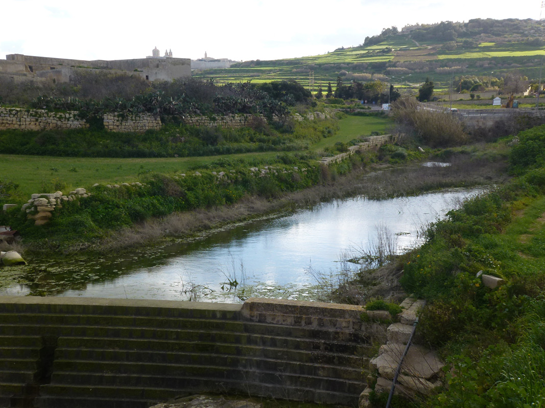
Wied tal-Qlejgħa (MAL026) is located within Ir-Rabat and Il-Mosta. Another part of this valley system, coded MAL030, has been included in the MedIsWet database and is located further upstream to MAL026.
The site at MAL026 includes two main roads that cross over the wetland, these are Triq San Pawl tal-Qliegħa and Triq Buqana. The study area is similar to a rock-pool type environment. The site proper is a dammed watercourse.
The watercourse is relatively shallow. Species include Eucalyptus trees, Foeniculum vulgare, Arundo donax, Piptatherum miliaceum, Hipparhenia hirta, Ricinus communis, Dittrichia viscosa, Aster squamatus and Acacia saligna indicating the disturbed nature from an ecological point of view of this part of the watercourse; this disturbed habitat can be described throughout the remainder of the site up to Buqana. There are pockets of typical watercourse species and species of interest. In this section, species of interest include Scirpoides holoschoenus. A small maquis-type community can be noted on the banks with some typical species including Erica multiflora, Olea europaea, Asparagus aphyllus and Prunis dulcis. Close to the boreholes Eucalyptus and Acacia trees are dominant; Scirpus holoschoenus is also present. As throughout most of this watercourse Arundo donax is also dominant.
During the field visits it was noted that the water bodies were dominated by the Common Duckweed (Lemna minor L.); other typical watercourse species noted included Typha domingensis and Rumex conglomerates. Evidence of eutrophication was noted during the field visit. From an ecological point of view, this area is highly disturbed with Ricinus communis scrub and ruderals representing the dominant vegetation. Agricultural land surrounds this area.
Wetland data
Basic information
Wetland location:
Inland
Wetland type:
Artificial
Wetland area:
0.70 Ha
Hydrological interaction:
Yes
Water salinity:
Fresh (< 0.5 g/l)
Type of fresh water input:
Torrent / Stream - Unconfined aquifer
Surface water runoff
Outflow controlled by dam
Open water area (%):
26 - 50
Hydroperiod:
Permanent
Geographic information
Census district:
Western
Island:
Malta
Local council:
Ir-Rabat
Longitude:
14.407790 East
Latitude:
35.903150 North
Biological significance
Biological significance:
Medium
Ramsar wetland type
Type
Coverage (%)
6 -- Water storage areas; reservoirs/barrages/dams/impoundments (generally over 8 ha)
Property status
Public
Protection statuses
Protection status category
Protection status subcategory
Area's name
Code
Coverage area (%)
Legislation
National
Area of Ecological Importance/Site of Scientific Importance
Sistema ta' Widien tas-Salina
555552415
100
Development Planning Act (Act VII of 2016)
National
Area of High Landscape Value
Chadwick Lakes u parti mill-Imdina
555546315
100
Development Planning Act (Act VII of 2016)
CDDA protection status
CDDA code
CDDA category
MT02
Area of Ecological Importance/Site of Scientific Importance
MT15
Area of High Landscape Value
Ecosystem services
Type of ecosystem service
Ecosystem service
Scale of Βenefit (%)
Importance
Regulatory services
Flood hazard regulation
Provisioning services
Fresh water
Supporting services
Nutrient cycling
Supporting services
Provision of habitat
Activities on wetland
Activity
Intensity
020 = Resource conservation
High
502 = roads motorways
High
701 = water pollution
High
710 = Noise nuisance
Medium
852 = modifying structures of inland water courses
High
910 = Silting up
Medium
Activities on catchment area
Activity
Intensity
101 = modification of cultivation practices
Medium
110 = Use of pesticides
Medium
120 = Fertilisation
Medium
430 = Agricultural structures
Low
502 = roads motorways
High
701 = water pollution
High
710 = Noise nuisance
High
852 = modifying structures of inland water courses
High
Impacts
Impact
Intensity
EB- = Increase in aesthetic qualities
High
EF- = Increase in protection from natural forces
High
ER- = Increase in flow regulation
High
ES- = Increase in water supply
Medium
PF- = Fertilizer/Excess nutrient pollution
High
PP- = Pesticide pollution
Medium
Vegetation types
Type
Coverage (%)
Floating-leaved
5 - 25
Emergent
Flora
Species
Presence status
References
Typha domingensis
Images
Nature Trust Malta. (2019). MtIsWet – Database of the Maltese Islands Wetlands. Updated: 04.2024