MAL030 - Il-Wied tal-Qlejgha 2
Description
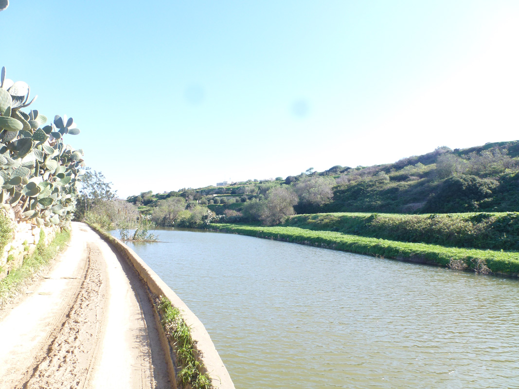
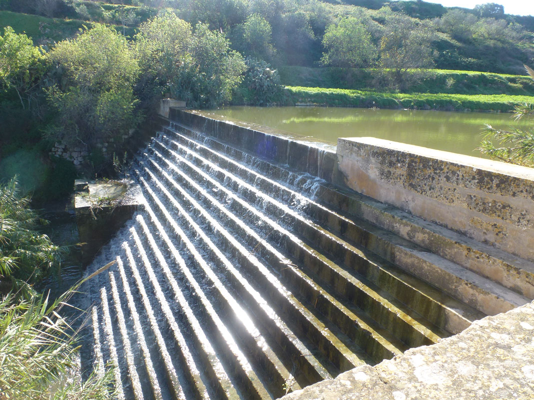
The site consists of a stretch of watercourse that is intercepted by dams such that the site retains water even outside of the rainy season. The site is scheduled as an Area of Ecological Importance and a Site of Scientific Importance through Government Notice 1236 of 2012. The watercourse is scheduled as a level 1 Site of Scientific Importance for the only known locality for the freshwater snail Lymnaea peregra and the hemipteran Nabis ferus. As reported in the Government Notice, this part of the watercourse also supports other freshwater snails (Physella acuta and Lymnaea truncatula) and the freshwater beetle Gyrinus dejeani.The site includes what can be described as a degraded wetland. The habitat consists of an area that is inundated with water, however, it is not dominated by hygrophytes, instead ruderal species are dominant. A pond area The area is part of an ongoing restoration plan that is currently (at the time of writing, i.e.2019) in the implementation process and therefore habitats recorded during the baseline may have changed or since been removed since fieldwork was carried out in 2018. For instance, the Arundo donax reed bed has been almost completely removed in a bid to allow for rare riparian habitats of conservation interest (also at European Level) to take over and colonise this area following planting and bio-engineering works. A Poplar gallery is located upstream similar to the one located behind the dam after Tas-Slampa, the aim of the restoration plan is to extend this habitat type and therefore improve the ecological value of the area. Part of the restoration works included dredging and removing silt from behind the dams to improve water storage capacity and help Malta to achieve its goals in this regard. The area behind the large dam was previously characterised by dominant hygrophytes including Rumex crispus, Ranunculus muricatus, Apium nodiflorum, Ranunculus saniculifolius, Mentha pulegium, Rumex conglomeratus and Holoschoenus scirpoides. A population of Phragmites tenuifolia was also present. The drier areas were dominated by ruderal species. During the restoration works, the hygrophyte seed bank was retained whereby the top metre of silt/soil was moved to the banks of the watercourse until restoration works are completed.

Wetland data
Basic information
| Wetland location: | Inland |
| Wetland type: | Artificial |
| Wetland area: | 1.80 Ha |
| Hydrological interaction: | Yes |
| Water salinity: | Fresh (< 0.5 g/l) |
| Type of fresh water input: | Torrent / Stream - Unconfined aquifer |
| Surface water runoff | Outflow controlled by dam |
| Open water area (%): | 26 - 50 |
| Hydroperiod: | Permanent |
Geographic information
| Census district: | Western |
| Island: | Malta |
| Local council: | Ir-Rabat |
| Longitude: | 14.389970 East |
| Latitude: | 35.892680 North |
Biological significance
| Biological significance: | High |
Ramsar wetland type
| Type | Coverage (%) |
| 6 -- Water storage areas; reservoirs/barrages/dams/impoundments (generally over 8 ha) |
Property status
| Public |
| Protection status category | Protection status subcategory | Area's name | Code | Coverage area (%) | Legislation |
| National | Area of Ecological Importance/Site of Scientific Importance | Chadwick Lakes u parti mill-Imdina | 555552415 | 100 | Development Planning Act (Act VII of 2016) |
| National | Area of High Landscape Value | Sistema ta' Widien tas-Salina | 555546315 | 100 | Development Planning Act (Act VII of 2016) |
CDDA protection status
| CDDA code | CDDA category |
| MT02 | Area of Ecological Importance/Site of Scientific Importance |
| MT15 | Area of High Landscape Value |
Ecosystem services
| Type of ecosystem service | Ecosystem service | Scale of Βenefit (%) | Importance |
| Cultural services | Cultural heritage | ||
| Provisioning services | Fresh water | ||
| Supporting services | Nutrient cycling | ||
| Supporting services | Provision of habitat | ||
| Cultural services | Recreation and tourism | ||
| Regulatory services | Water purification | ||
| Regulatory services | Water regulation |
Activities on wetland
| Activity | Intensity |
| 010 = Habitat conservation | High |
| 030 = Species conservation | High |
| 507 = bridge viaduct | High |
| 701 = water pollution | High |
| 852 = modifying structures of inland water courses | High |
| 853 = management of water levels | High |
| 870 = Dykes embankments artificial beaches general | High |
| 954 = invasion by a species | High |
Activities on catchment area
| Activity | Intensity |
| 010 = Habitat conservation | High |
| 100 = Cultivation | High |
| 110 = Use of pesticides | High |
| 120 = Fertilisation | High |
| 130 = Irrigation | High |
| 230 = Hunting | High |
| 403 = dispersed habitation | Low |
| 423 = disposal of inert materials | Low |
| 430 = Agricultural structures | Medium |
| 501 = paths tracks cycling tracks | High |
| 502 = roads motorways | High |
| 507 = bridge viaduct | High |
| 623 = motorised vehicles | Medium |
| 690 = Other leisure and tourism impacts | High |
| 954 = invasion by a species | High |
Impacts
| Impact | Intensity |
| EB- = Increase in aesthetic qualities | High |
| ED- = Increase in sediment removal/retention | High |
| ER- = Increase in flow regulation | High |
| ES- = Increase in water supply | High |
| EU- = Increase of tourist/recreation potential | High |
| EW- = Increase in wilderness/wildlife values | High |
| FCP = Introduction of animal pests | High |
| PF- = Fertilizer/Excess nutrient pollution | High |
| PP- = Pesticide pollution | |
| SS- = Soil siltation | |
| VCD = Loss of floral diversity | |
| VCX = Introduction of exotic floral species | |
| VP- = Decrease in population of floral species |
Habitat types
| Type | Coverage (%) |
| 92A0 Salix alba and Populus alba galleries | 5 - 25 |
Vegetation types
| Type | Coverage (%) |
| Wet meadow | |
| Emergent | 76 - 95 |
| Shrubby / Arborescent | 5 - 25 |
| Halophytic | |
| Other | |
| Submerged | 5 - 25 |
Flora
| Species | Presence status | References |
| Acacia saligna | ||
| Acanthus mollis | ||
| Arum italicum | ||
| Arundo donax | ||
| Aster squamatus | ||
| Bellardia trixago | ||
| Borago officinalis | ||
| Cynodon dactylon | ||
| Diplotaxis tenuifolia | ||
| Eucalyptus camaldulensis | ||
| Ferula communis | ||
| Glebionis coronaria | ||
| Hordeum vulgare | ||
| Lavatera arborea | ||
| Malva cretica | ||
| Malva sylvestris | ||
| Mercurialis annua | ||
| Olea europaea | ||
| Opuntia ficus-indica | ||
| Oxalis pes-caprae | ||
| Phragmites australis | ||
| Populus alba | ||
| Prunus dulcis | ||
| Reichardia picroides | ||
| Ricinus communis | ||
| Sambucus nigra | ||
| Smyrnium olusatrum | ||
| Urginea pancration | ||
| Yucca gloriosa |
Fauna
Reptiles |
Presence status in wetland |
References |
|
| Chalcides ocellatus tiligugu (Gmelin, 1789) | |||
| Coluber viridiflavus (Lacepede, 1789) | |||
Amphibians |
Presence status in wetland |
References |
|
| Discoglossus pictus (Otth, 1837) | |||
Invertebrates |
Presence status in wetland |
References |
|
| Chrysolina grossa (Fabricius, 1792) | |||
| Dytiscus circumflexus (Fabricius, 1801) | |||
| Orius spp. | |||
| Macrolophus spp. | |||
| Trigonotylus spp. | |||
| Notonecta maculata (Fabricius, 1794) | |||
| Andrena nigroaenea (Kirby, 1802) | |||
| Apis mellifera (Linnaeus, 1758) | |||
| Bombus terrestris (Linnaeus, 1758) | |||
| Ceratina | |||
| Xylocopa violaceae (Linnaeus, 1758) | |||
| Hylaeus | |||
| Halictus fulvipes (Klug, 1817) | |||
| Lassioglossum | |||
| Seladonia gemmea (Dours, 1872) | |||
| Anthidium | |||
| Osmia latreillei (Spinola, 1806) | |||
| Polistes gallicus (Linnaeus, 1758) | |||
| Celastrina argiolus (Linnaeus, 1758) | |||
| Leptotes pirithous (Linnaeus, 1767) | |||
| Pararge aegeria (Linnaeus, 1758) | |||
| Vanessa atalanta (Linnaeus, 1758) | |||
| Pieris rapae (Linnaeus, 1758) | |||
| Chrysoperla carnea (Stephens, 1836) | |||
| Anax imperator (Leach, 1815) | |||
| Anax parthenope (Selys, 1839) | |||
| Ischnura genei | |||
| Crocothemis erythraea (Morton, 1920) | |||
| Orthetrum cancellatum (Linnaeus, 1758) | |||
| Orthetrum coarulescens anceps (Schneider, 1845) | |||
| Orthetrum trinacria (Selys, 1841) | |||
| Selysiothemis nigra (Vander Linden, 1825) | |||
| Sympetrum fonscolombii (Selys, 1840) | |||
| Procambarus clarkii (Girard, 1852) | |||
| Lymnaea truncatula (O. F. Müller, 1774) | |||
| Theba pisana (O.F. Müller, 1774) | |||
| Radix peregra (Linnaeus, 1758) | |||
| Physella acuta (Draparnaud, 1805) | |||
| Trochoidea spratti (L. Pfeiffer, 1846) |
Images