MAL039 - Wied is-Sewda
Description
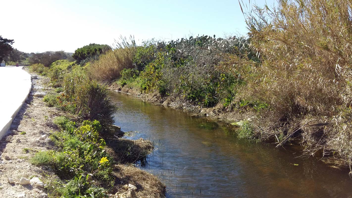
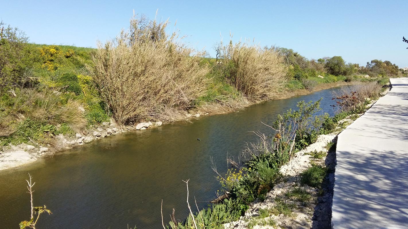
Wied Is-Sewda is a deep V-shaped watercourse which is cut in Lower and Middle Globigerina Limestone and discharges at il-Menqa in the Grand Harbour - the submerged extension of this valley. The site has been degraded for many years. Species noted during the survey included Ricinis communis, Arundo donax, Acacia sp., and Rumex conglomeratus. Agricultural land surrounds the area. A recent concrete road was built adjacent to the watercourse and dumping is reported frequently. Dumping of construction material was in fact witnessed during the site visit.

Wetland data
Basic information
| Wetland location: | Inland |
| Wetland type: | Artificial |
| Wetland area: | 2.50 Ha |
| Hydrological interaction: | Yes |
| Water salinity: | Fresh (< 0.5 g/l) |
| Type of fresh water input: | Catchment area (precipitation) |
| Surface water runoff | Other |
| Open water area (%): | 51 - 75 |
| Hydroperiod: | Seasonal |
Geographic information
| Census district: | Western |
| Island: | Malta |
| Local council: | H'Attard |
| Longitude: | 14.454160 East |
| Latitude: | 35.884880 North |
Biological significance
| Biological significance: | Low |
Ramsar wetland type
| Type | Coverage (%) |
| 6 -- Water storage areas; reservoirs/barrages/dams/impoundments (generally over 8 ha) |
Property status
| Public |
Ecosystem services
| Type of ecosystem service | Ecosystem service | Scale of Βenefit (%) | Importance |
| Supporting services | Provision of habitat | ||
| Cultural services | Recreation and tourism |
Activities on wetland
| Activity | Intensity |
| 290 = Hunting fishing activities not referred to above | Medium |
| 502 = roads motorways | High |
| 852 = modifying structures of inland water courses | High |
| 920 = Drying out | High |
| 952 = eutrophication | High |
| 954 = invasion by a species | High |
| 967 = antagonism with domestic animals | Medium |
Activities on catchment area
| Activity | Intensity |
| 100 = Cultivation | High |
| 110 = Use of pesticides | |
| 120 = Fertilisation | |
| 130 = Irrigation | High |
| 140 = Grazing | |
| 170 = Animal breeding | |
| 290 = Hunting fishing activities not referred to above | |
| 403 = dispersed habitation | |
| 430 = Agricultural structures | |
| 502 = roads motorways |
Impacts
| Impact | Intensity |
| AS- = Loss of scenic value | Medium |
| FCD = Loss of faunal diversity | High |
| HF- = Habitat fragmentation | High |
| HL- = Habitat loss | High |
| LW- = Decrease in wilderness/wildlife values | High |
| PF- = Fertilizer/Excess nutrient pollution | High |
| PP- = Pesticide pollution | Medium |
| VCD = Loss of floral diversity | |
| VCX = Introduction of exotic floral species |
Vegetation types
| Type | Coverage (%) |
| Emergent | 5 - 25 |
| Other | |
| Shrubby / Arborescent |
Flora
| Species | Presence status | References |
| Acacia karoo | ||
| Acacia saligna | ||
| Arundo donax | ||
| Cyperus sp. | ||
| Eucalyptus sp. | ||
| Potentilla reptans | ||
| Ricinus communis | ||
| Rumex conglomeratus |
Images