MAL047 - Gnien iz-Zghir
Description
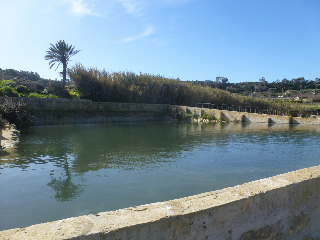
Ġnien iż-Żgħir is a semi-artificial reservoir, intended for irrigation and water storage, located in western Malta between Ħad-Dingli and Rabat. The reservoir covers an area of approximately 1,420m2. A limestone wall has been constructed around the border in order to increase the reservoir’s water storage capacity. The site is surrounded by agricultural fields and has numerous pipelines within the reservoirs, indicating that it is used for irrigation. The site is not protected by any legislation.

Wetland data
Basic information
| Wetland location: | Inland |
| Wetland type: | Artificial |
| Wetland area: | 0.10 Ha |
| Hydrological interaction: | - |
| Water salinity: | Fresh (< 0.5 g/l) |
| Type of fresh water input: | Catchment area (precipitation) |
| Surface water runoff | Outflow controlled by pipeline |
| Open water area (%): | > 95 |
| Hydroperiod: | Permanent |
Geographic information
| Census district: | Western |
| Island: | Malta |
| Local council: | Ir-Rabat |
| Longitude: | 14.404110 East |
| Latitude: | 35.868110 North |
Biological significance
| Biological significance: | Low |
Ramsar wetland type
| Type | Coverage (%) |
| 6 -- Water storage areas; reservoirs/barrages/dams/impoundments (generally over 8 ha) |
Property status
| Private |
| Protection status category | Protection status subcategory | Area's name | Code | Coverage area (%) | Legislation |
| International | Special Areas of Conservation - International Importance | L-Inhawi tal-Buskett - Girgenti | 330714 | 100 | Environment Protection Act (Act I of 2016) |
| International | Special Protection Areas | L-Inhawi tal-Buskett u tal-Girgenti | 555552407 | 100 | Environment Protection Act (Act I of 2016) |
| National | Tree Protection Area | Gnien il-Kbir, il-Buskett u Wied il-Girgenti | 555546279 | 100 | Environment Protection Act (Act I of 2016) |
| International | Important Bird and Biodiversity Areas | Buskett and Wied il-Luq | MT004 | 100 |
CDDA protection status
| CDDA code | CDDA category |
| MT11 | Special Areas of Conservation - International Importance |
| MT13 | Special Protection Areas |
| MT06 | Tree Protection Area |
Important bird areas
| IBA code | Site name | Coverage (%) | References |
| MT004 | Buskett and Wied il-Luq | 100 |
Ecosystem services
| Type of ecosystem service | Ecosystem service | Scale of Βenefit (%) | Importance |
| Provisioning services | Food | ||
| Provisioning services | Fresh water |
Activities on wetland
| Activity | Intensity |
| 020 = Resource conservation | High |
| 110 = Use of pesticides | High |
| 120 = Fertilisation | High |
| 130 = Irrigation | High |
| 700 = Pollution | High |
| 701 = water pollution | High |
Activities on catchment area
| Activity | Intensity |
| 100 = Cultivation | High |
| 110 = Use of pesticides | High |
| 120 = Fertilisation | High |
| 130 = Irrigation | High |
| 430 = Agricultural structures | Low |
| 701 = water pollution | High |
Impacts
| Impact | Intensity |
| EE- = Increase of economic potential | High |
| ES- = Increase in water supply | High |
| PF- = Fertilizer/Excess nutrient pollution | High |
| PP- = Pesticide pollution | High |
Vegetation types
| Type | Coverage (%) |
| Other | < 5 |
Images