
MAL052 - Ta' Kassja
Description
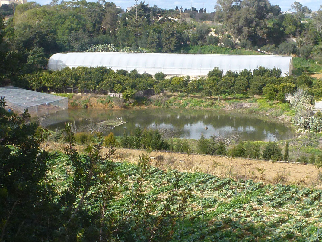
Ta’ Kassja is an artificially constructed pond, located in western Malta between Rabat and Ħad-Dingli. The pond itself has no visible concrete structures, apart from a concrete platform in the middle. The pond covers an approximate area 1,950m2 and is not accessible to the public as it is located in privately-owned land without any passageways. The site is predominantly surrounded by agricultural land. On site, there was no indication that the pond is being used for irrigation, however, the presence of an aviary on the pond’s border indicates it is potentially being used for hunting activities. The site is not protected by any legislation.
Wetland data
Basic information
| Wetland location: | Inland |
| Wetland type: | Artificial |
| Wetland area: | 0.20 Ha |
| Hydrological interaction: | Yes |
| Water salinity: | Fresh (< 0.5 g/l) |
| Type of fresh water input: | Catchment area (precipitation) |
| Surface water runoff | Other |
| Open water area (%): | > 95 |
| Hydroperiod: | Permanent |
Geographic information
| Census district: | Western |
| Island: | Malta |
| Local council: | Had-Dingli |
| Longitude: | 14.378950 East |
| Latitude: | 35.866900 North |
Biological significance
| Biological significance: | Low |
Ramsar wetland type
| Type | Coverage (%) |
| 2 -- Ponds; includes farm ponds, stock ponds, small tanks; (generally below 8 ha) |
Property status
| Private |
Ecosystem services
| Type of ecosystem service | Ecosystem service | Scale of Βenefit (%) | Importance |
| Provisioning services | Food | ||
| Provisioning services | Fresh water | ||
| Cultural services | Recreation and tourism | ||
| Regulatory services | Water regulation |
Activities on wetland
| Activity | Intensity |
| 020 = Resource conservation | High |
| 130 = Irrigation | High |
| 230 = Hunting | High |
| 701 = water pollution | High |
Activities on catchment area
| Activity | Intensity |
| 100 = Cultivation | High |
| 110 = Use of pesticides | High |
| 120 = Fertilisation | High |
| 130 = Irrigation | High |
| 230 = Hunting | High |
| 430 = Agricultural structures | Medium |
| 501 = paths tracks cycling tracks | Medium |
| 701 = water pollution | High |
Impacts
| Impact | Intensity |
| EB- = Increase in aesthetic qualities | High |
| EE- = Increase of economic potential | High |
| ES- = Increase in water supply | High |
| PF- = Fertilizer/Excess nutrient pollution | High |
| PP- = Pesticide pollution |
Images


