
MAL069 - It-Tghatigha
Description
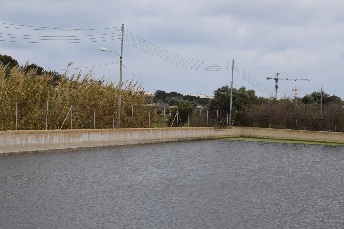
It-Tghatigha is an artificially constructed reservoir, intended for irrigation and water storage, located in southern Malta within Santa Luċija. The reservoir is constructed out of cement and covers an approximate area of 1,630m2. The site is accessible by a surfaced road, however, the reservoir itself is fenced off. Surfaced roads are located to the north and west of the reservoir, with an abandoned field to the east and active agricultural land to the south indicating that the reservoir is likely being used for irrigation. The site has no vegetation present within the border, however, it is located close to Wied ta’ Garnaw. Within the reservoir, a large population of Lemna minor L. is present. The site is not protected under any legislation.
Wetland data
Basic information
| Wetland location: | Inland |
| Wetland type: | Artificial |
| Wetland area: | 0.20 Ha |
| Hydrological interaction: | - |
| Water salinity: | Fresh (< 0.5 g/l) |
| Type of fresh water input: | Catchment area (precipitation) |
| Surface water runoff | Other |
| Open water area (%): | > 95 |
| Hydroperiod: | Permanent |
Geographic information
| Census district: | South Eastern |
| Island: | Malta |
| Local council: | Santa Lucija |
| Longitude: | 14.506050 East |
| Latitude: | 35.860170 North |
Biological significance
| Biological significance: | Low |
Ramsar wetland type
| Type | Coverage (%) |
| 6 -- Water storage areas; reservoirs/barrages/dams/impoundments (generally over 8 ha) |
Property status
| Private |
Ecosystem services
| Type of ecosystem service | Ecosystem service | Scale of Βenefit (%) | Importance |
| Provisioning services | Food | ||
| Provisioning services | Fresh water |
Activities on wetland
| Activity | Intensity |
| 020 = Resource conservation | High |
| 130 = Irrigation | Medium |
| 701 = water pollution | Medium |
| 954 = invasion by a species | High |
Activities on catchment area
| Activity | Intensity |
| 100 = Cultivation | Medium |
| 110 = Use of pesticides | Medium |
| 120 = Fertilisation | Medium |
| 130 = Irrigation | Medium |
| 401 = continuous urbanisation | High |
| 402 = discontinuous urbanisation | Medium |
| 709 = other forms or mixed forms of pollution | High |
Impacts
| Impact | Intensity |
| EE- = Increase of economic potential | High |
| ES- = Increase in water supply | Medium |
| PF- = Fertilizer/Excess nutrient pollution | Medium |
| PP- = Pesticide pollution | High |
Vegetation types
| Type | Coverage (%) |
| Floating-leaved | 5 - 25 |
Flora
| Species | Presence status | References |
| Lemna minor |
Images

