MAL071 - Tas-Salvatur
Description
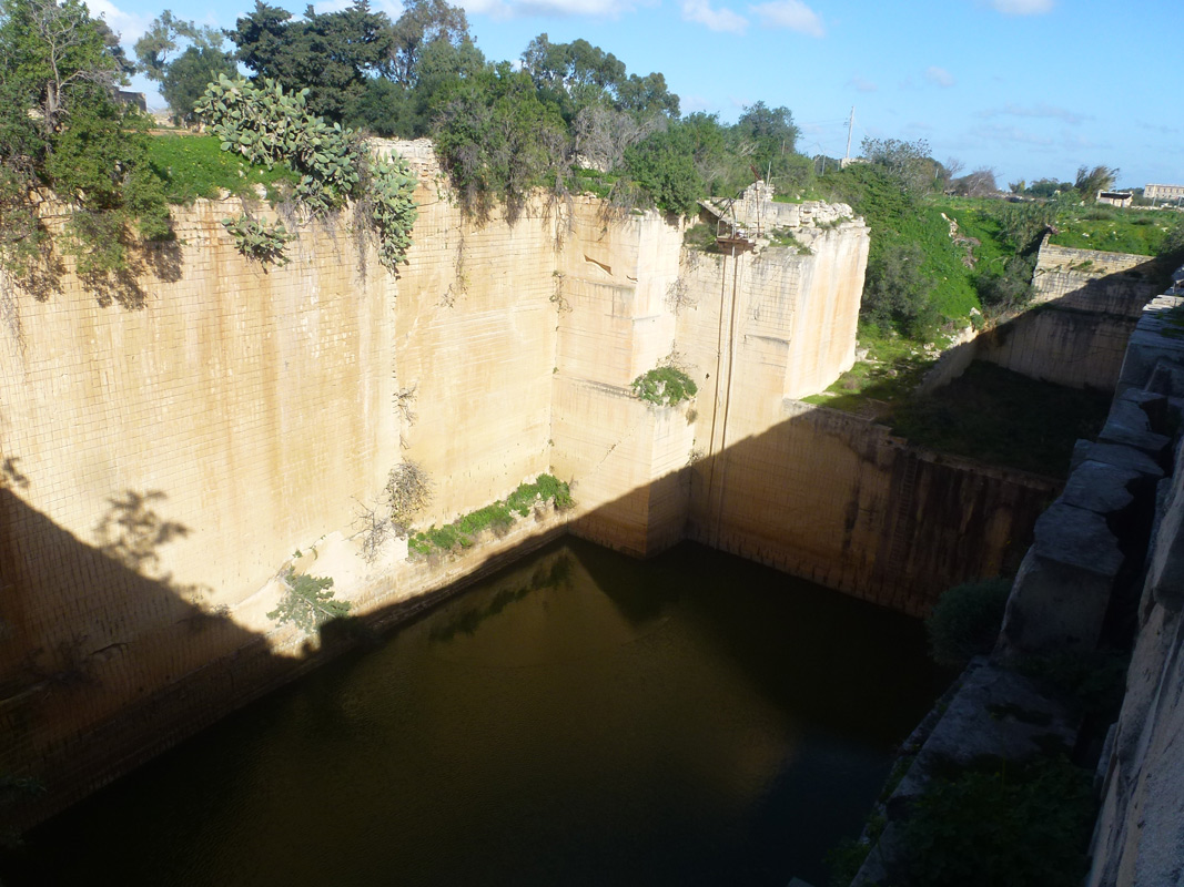
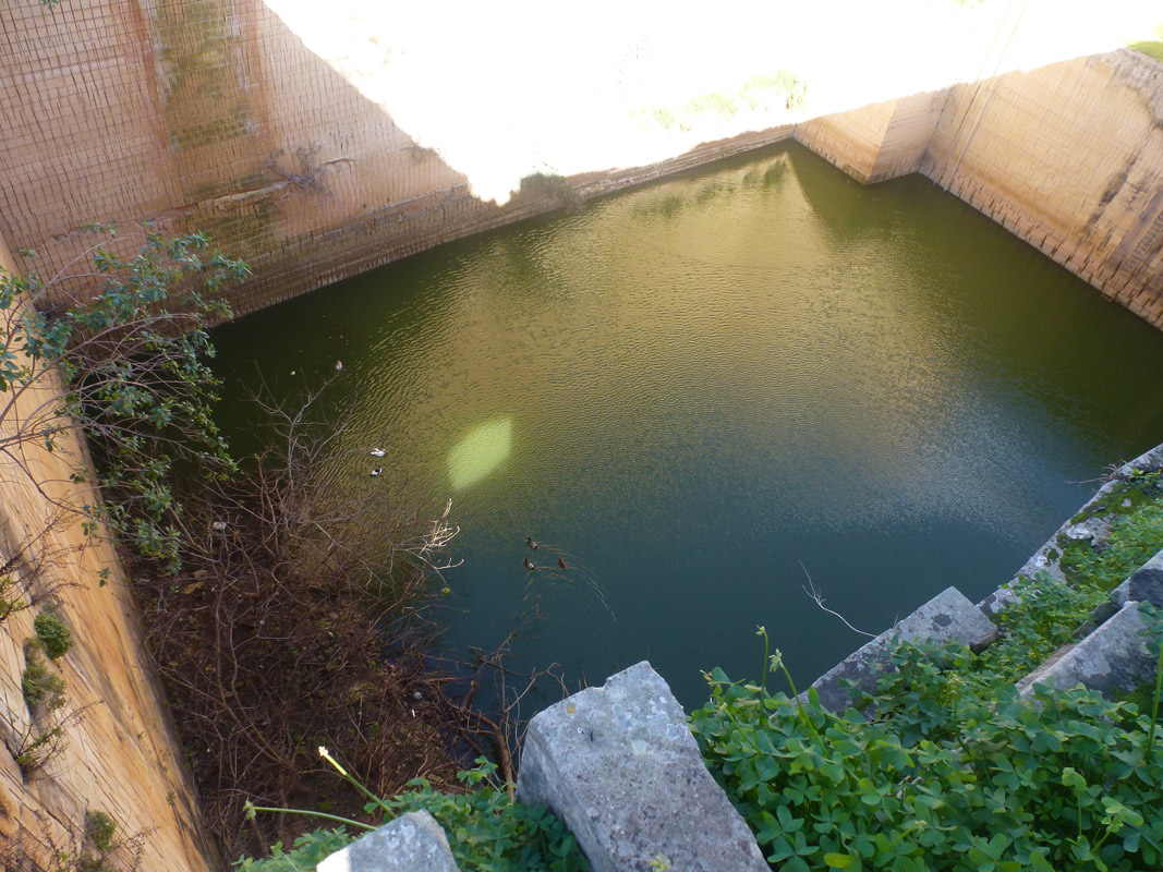
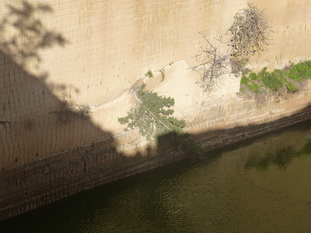
Tas-Salvatur is a disused quarry that is being used as a reservoir for water storage and irrigation, located in south-western Malta between Siġġiewi and L-Imqabba. The quarry is owned by the government and has been inactive for over 35 years. It covers an approximate area of 1,150m2 and is capable of holding a maximum of 5 metres of water in height before water is lost through crevasses. The site is accessible by a dirt pathway from a main road. The site is predominantly surrounded by agricultural fields, however, an active quarry lies directly south of the Tas-Salvatur disused quarry. No important community habitats were recorded. Cupressus sempervirens, Opuntia ficus-indica and Capparis orientalis are present growing on the quarry’s walls alongside other rudimental vegetation. The site is not protected by any legislation.

Wetland data
Basic information
| Wetland location: | Inland |
| Wetland type: | Artificial |
| Wetland area: | 0.10 Ha |
| Hydrological interaction: | - |
| Water salinity: | Fresh (< 0.5 g/l) |
| Type of fresh water input: | Catchment area (precipitation) |
| Surface water runoff | Other |
| Open water area (%): | 76 - 95 |
| Hydroperiod: | Permanent |
Geographic information
| Census district: | Western |
| Island: | Malta |
| Local council: | Is-Siggiewi |
| Longitude: | 14.455790 East |
| Latitude: | 35.850040 North |
Biological significance
| Biological significance: | Low |
Ramsar wetland type
| Type | Coverage (%) |
| 7 -- Excavations; gravel/brick/clay pits; borrow pits, mining pools |
Property status
| Public |
Ecosystem services
| Type of ecosystem service | Ecosystem service | Scale of Βenefit (%) | Importance |
| Regulatory services | Flood hazard regulation | ||
| Provisioning services | Fresh water | ||
| Regulatory services | Water regulation |
Activities on wetland
| Activity | Intensity |
| 301 = quarries | Low |
| 701 = water pollution | High |
| 703 = soil pollution | High |
| 910 = Silting up | Medium |
Activities on catchment area
| Activity | Intensity |
| 100 = Cultivation | High |
| 110 = Use of pesticides | High |
| 120 = Fertilisation | High |
| 130 = Irrigation | High |
| 301 = quarries | Medium |
| 424 = other discharges | High |
| 430 = Agricultural structures | High |
| 701 = water pollution | High |
| 703 = soil pollution | High |
Impacts
| Impact | Intensity |
| ES- = Increase in water supply | Low |
| EW- = Increase in wilderness/wildlife values | High |
| PF- = Fertilizer/Excess nutrient pollution | High |
| PP- = Pesticide pollution | Medium |
Images