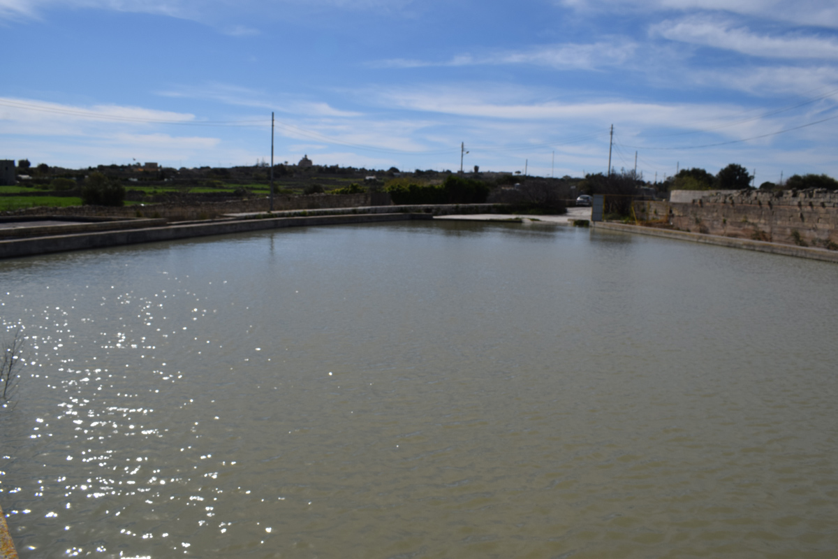
Wied ta’ Sant Andrija is an artificially constructed reservoir, intended for water storage and flood prevention, located in western Malta within Is-Siġġiewi. The reservoir is constructed out of cement and covers an approximate area of 1,200m2. The site is accessible to the public by a surfaced road. A culvert was present on an active surfaced road, channelling water to the reservoir indicating it is being used as a flood prevention measure. The site is surrounded by surfaced roads and residential dwellings, however, active agricultural land is present to the north. It is unclear if the reservoir is being used for irrigation as pipelines were not visible. Within the basin of the reservoir, a sizable population of rudimental species were present, whilst within the reservoir a minute population of Rumex conglomeratus was present. The site is not protected under any legislation
Wetland data
Basic information
Wetland location:
Inland
Wetland type:
Artificial
Wetland area:
0.10 Ha
Hydrological interaction:
-
Water salinity:
Fresh (< 0.5 g/l)
Type of fresh water input:
Catchment area (precipitation)
Surface water runoff
There is no obvious water outflow
Open water area (%):
> 95
Hydroperiod:
Permanent
Geographic information
Census district:
Western
Island:
Malta
Local council:
Is-Siggiewi
Longitude:
14.434480 East
Latitude:
35.847290 North
Biological significance
Biological significance:
Low
Ramsar wetland type
Type
Coverage (%)
6 -- Water storage areas; reservoirs/barrages/dams/impoundments (generally over 8 ha)
Property status
Public
Ecosystem services
Type of ecosystem service
Ecosystem service
Scale of Βenefit (%)
Importance
Provisioning services
Food
Provisioning services
Fresh water
Activities on wetland
Activity
Intensity
020 = Resource conservation
High
130 = Irrigation
Medium
701 = water pollution
Medium
Activities on catchment area
Activity
Intensity
100 = Cultivation
Medium
110 = Use of pesticides
Medium
120 = Fertilisation
Medium
130 = Irrigation
Medium
402 = discontinuous urbanisation
Medium
430 = Agricultural structures
Low
502 = roads motorways
High
701 = water pollution
Medium
Impacts
Impact
Intensity
EE- = Increase of economic potential
High
ES- = Increase in water supply
Medium
PF- = Fertilizer/Excess nutrient pollution
Medium
PP- = Pesticide pollution
Vegetation types
Type
Coverage (%)
Wet meadow
< 5
Flora
Species
Presence status
References
Plantago major
Images
Nature Trust Malta. (2019). MtIsWet – Database of the Maltese Islands Wetlands. Updated: 04.2024