MAL086 - Ras il-Qali
Description
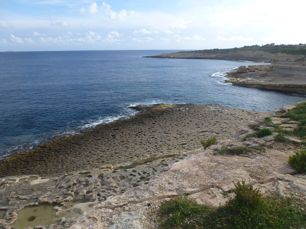
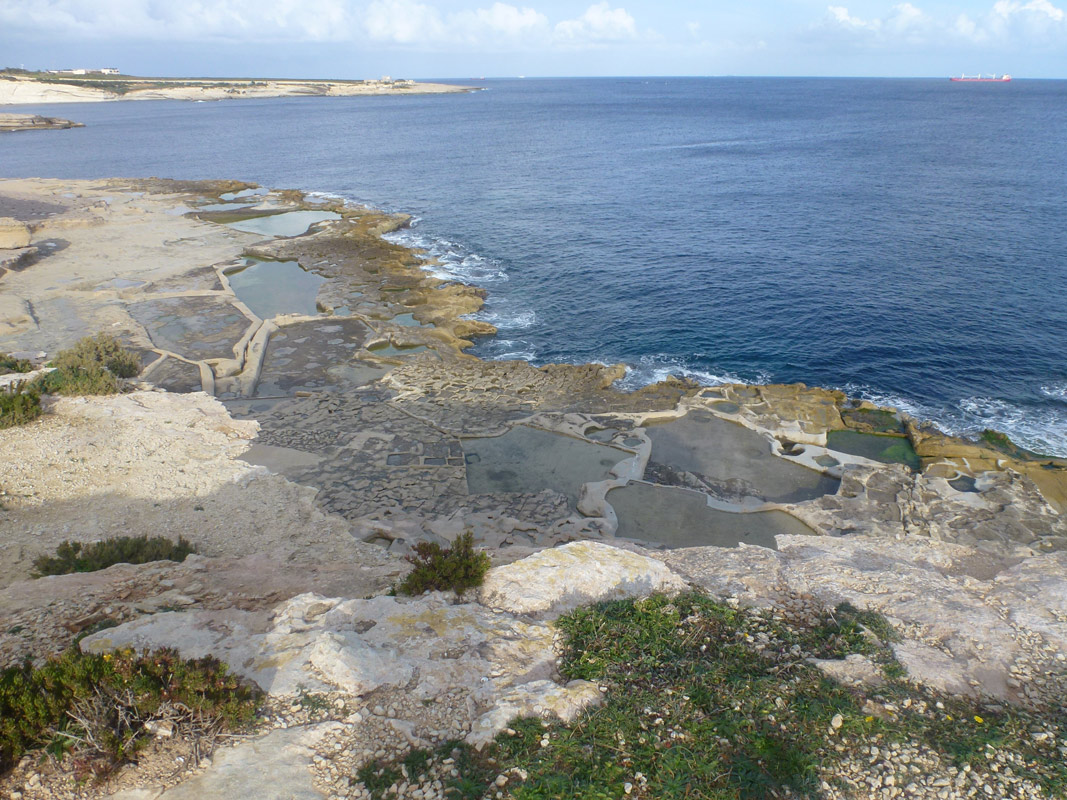
Ras il-Qali are a series of salt pans, located in southern Malta, within Marsaxlokk. The site is not accessible to the public as it is located behind a locked gate on privately-owned land. The site covers an approximate area of 5,790m2. It is unclear whether the salt pans are still actively in use. No vegetation was present growing within and around the site. The salt pans are classified as an Area of Ecological Importance under G.N. 400/96 and lie within a No Trapping Zone under S.L. 504.1.
Wetland data
Basic information
| Wetland location: | Marine/Coastal |
| Wetland type: | Artificial |
| Wetland area: | 0.60 Ha |
| Hydrological interaction: | - |
| Water salinity: | Salty (> 18.0 g/l) |
| Type of fresh water input: | Catchment area (precipitation) |
| Surface water runoff | Other |
| Open water area (%): | 76 - 95 |
| Hydroperiod: | Permanent |
Geographic information
| Census district: | South Eastern |
| Island: | Malta |
| Local council: | Marsaxlokk |
| Longitude: | 14.563560 East |
| Latitude: | 35.834170 North |
Biological significance
| Biological significance: | Low |
Ramsar wetland type
| Type | Coverage (%) |
| 5 -- Salt exploitation sites; salt pans, salines, etc. |
Property status
| Private |
| Protection status category | Protection status subcategory | Area's name | Code | Coverage area (%) | Legislation |
| National | Area of Ecological Importance | Irdumijiet Ta' Madwar il-Kosta mid-Dahla ta' San Tumas sas-Sarc | 14784 | 100 | Development Planning Act (Act VII of 2016) |
| National | Area of High Landscape Value | Diversi Rdumijiet | 555546316 | 100 | Development Planning Act (Act VII of 2016) |
CDDA protection status
| CDDA code | CDDA category |
| MT01 | Area of Ecological Importance |
| MT15 | Area of High Landscape Value |
Ecosystem services
| Type of ecosystem service | Ecosystem service | Scale of Βenefit (%) | Importance |
| Cultural services | Cultural heritage | ||
| Supporting services | Provision of habitat |
Activities on wetland
| Activity | Intensity |
| 020 = Resource conservation | High |
| 340 = Salt works | High |
| 690 = Other leisure and tourism impacts | Low |
| 920 = Drying out | High |
Activities on catchment area
| Activity | Intensity |
| 402 = discontinuous urbanisation | Low |
| 501 = paths tracks cycling tracks | Low |
Impacts
| Impact | Intensity |
| EB- = Increase in aesthetic qualities | High |
| EE- = Increase of economic potential | High |
| EF- = Increase in protection from natural forces | Low |
| EO- = Increase potential for natural products | High |
| EU- = Increase of tourist/recreation potential |
Images