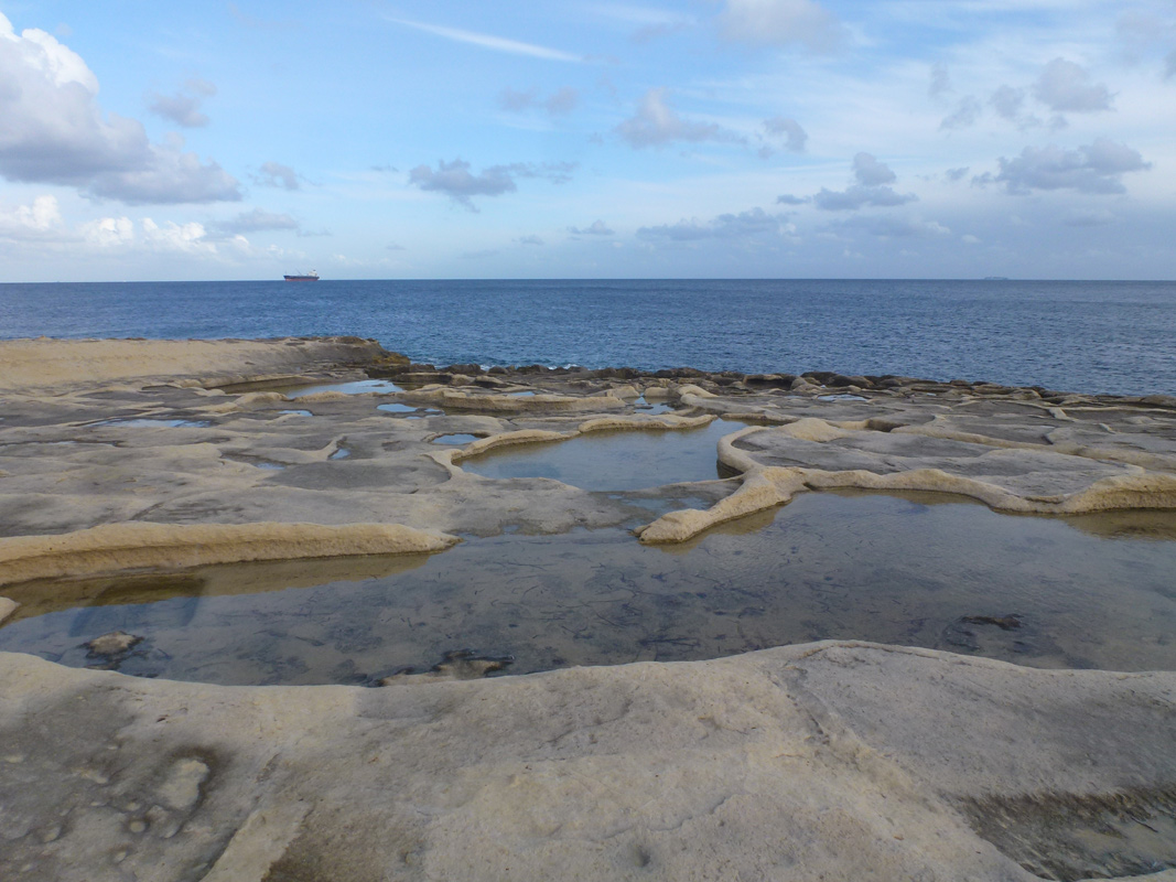
Il-Kalanka l-Fonda & il-Ponta tat-Tawwalija are a series of salt pans, located in southern Malta, between St. Peter’s Pool and Kalanka Bay within Marsaxlokk. The site is accessible to the public through multiple different unsurfaced roads. The salt pans cover an approximate area of 22,480m2. The salt pans were in derelict condition. Thus, it is likely they are not being used for salt production. The site is predominantly surrounded by natural habitats, with a handful of scattered residential buildings. Chrithmum maritimum and Suaeda maritima are present close to the salt pans. Due to the surrounding cliffs, the salt pans are classified as an Area of Ecological Importance under G.N. 400/ 96 and lie within a No Trapping Zone under S.L. 504.1.
Wetland data
Basic information
Wetland location:
Marine/Coastal
Wetland type:
Artificial
Wetland area:
2.20 Ha
Hydrological interaction:
-
Water salinity:
Salty (> 18.0 g/l)
Type of fresh water input:
Catchment area (precipitation)
Surface water runoff
Other
Open water area (%):
76 - 95
Hydroperiod:
Permanent
Geographic information
Census district:
South Eastern
Island:
Malta
Local council:
Marsaxlokk
Longitude:
14.562980 East
Latitude:
35.826420 North
Biological significance
Biological significance:
Low
Ramsar wetland type
Type
Coverage (%)
5 -- Salt exploitation sites; salt pans, salines, etc.
Property status
Public
Protection statuses
Protection status category
Protection status subcategory
Area's name
Code
Coverage area (%)
Legislation
National
Area of Ecological Importance
Irdumijiet Ta' Madwar il-Kosta mid-Dahla ta' San Tumas sas-Sarc
14784
100
Development Planning Act (Act VII of 2016)
National
Area of High Landscape Value
Diversi Rdumijiet
555546316
100
Development Planning Act (Act VII of 2016)
CDDA protection status
CDDA code
CDDA category
MT01
Area of Ecological Importance
MT15
Area of High Landscape Value
Ecosystem services
Type of ecosystem service
Ecosystem service
Scale of Βenefit (%)
Importance
Cultural services
Cultural heritage
Supporting services
Provision of habitat
Activities on wetland
Activity
Intensity
020 = Resource conservation
High
340 = Salt works
High
690 = Other leisure and tourism impacts
Low
800 = Landfill land reclamation and drying out
High
920 = Drying out
High
Activities on catchment area
Activity
Intensity
501 = paths tracks cycling tracks
Low
Impacts
Impact
Intensity
EB- = Increase in aesthetic qualities
High
EE- = Increase of economic potential
High
EF- = Increase in protection from natural forces
Low
EO- = Increase potential for natural products
High
EU- = Increase of tourist/recreation potential
High
Flora
Species
Presence status
References
Crithmum maritimum
Suaeda maritima
Images
Nature Trust Malta. (2019). MtIsWet – Database of the Maltese Islands Wetlands. Updated: 04.2024