MAL092 - Malta Freeport
Description
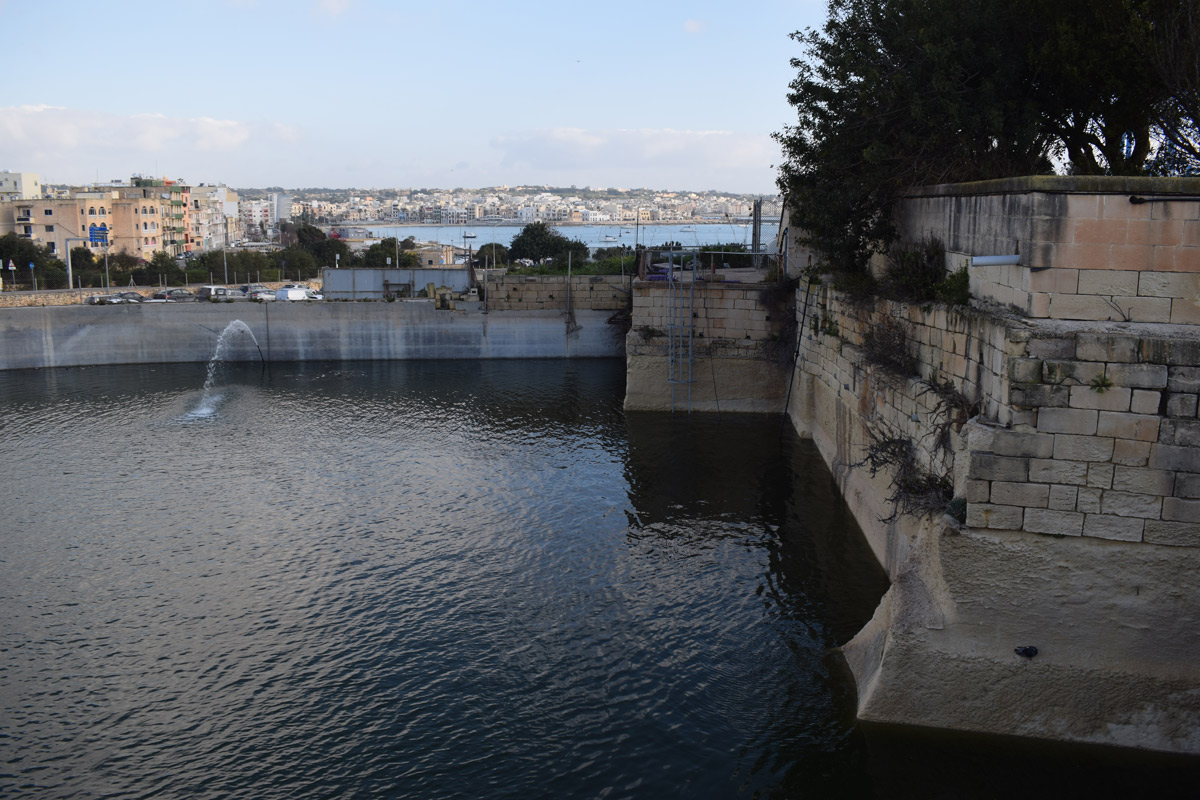
Malta Freeport is an old artificially constructed reservoir, intended for water storage and flood prevention, located in southern Malta within Birżebbuġa. The reservoir was mechanically excavated and has had its border extended via the use of limestone blocks. The site covers an approximate area of 1,370m2. The reservoir is accessible to the public by surfaced roads. A car park lies to the north and south of the site, a boatyard lies to the west whilst offices are located on the east. The reservoir is currently being used to store water from the nearby road surfaces, as a flood mitigation measure, and there is no indication if it is being used for irrigation. A small number of Ficus carica and Salix alba are growing within the basin.

Wetland data
Basic information
| Wetland location: | Inland |
| Wetland type: | Artificial |
| Wetland area: | 0.10 Ha |
| Hydrological interaction: | - |
| Water salinity: | Fresh (< 0.5 g/l) |
| Type of fresh water input: | Catchment area (precipitation) |
| Surface water runoff | Other |
| Open water area (%): | > 95 |
| Hydroperiod: | Permanent |
Geographic information
| Census district: | South Eastern |
| Island: | Malta |
| Local council: | Birzebbuga |
| Longitude: | 14.530470 East |
| Latitude: | 35.817210 North |
Biological significance
| Biological significance: | Low |
Ramsar wetland type
| Type | Coverage (%) |
| 6 -- Water storage areas; reservoirs/barrages/dams/impoundments (generally over 8 ha) |
Property status
| Public |
Ecosystem services
| Type of ecosystem service | Ecosystem service | Scale of Βenefit (%) | Importance |
| Regulatory services | Flood hazard regulation |
Activities on wetland
| Activity | Intensity |
| 020 = Resource conservation | High |
| 701 = water pollution | High |
| 790 = Other pollution/human impacts/activities | Medium |
| 952 = eutrophication | Low |
Activities on catchment area
| Activity | Intensity |
| 504 = port areas | High |
| 710 = Noise nuisance | Low |
Impacts
| Impact | Intensity |
| EE- = Increase of economic potential | High |
| ES- = Increase in water supply | High |
| PF- = Fertilizer/Excess nutrient pollution | Medium |
| PP- = Pesticide pollution | Low |
Vegetation types
| Type | Coverage (%) |
| Other | 5 - 25 |
| Shrubby / Arborescent | < 5 |
Flora
| Species | Presence status | References |
| Capparis spinosa | ||
| Ficus carica | ||
| Salix alba |
Images