MAL093 - Taht l-Irdum
Description
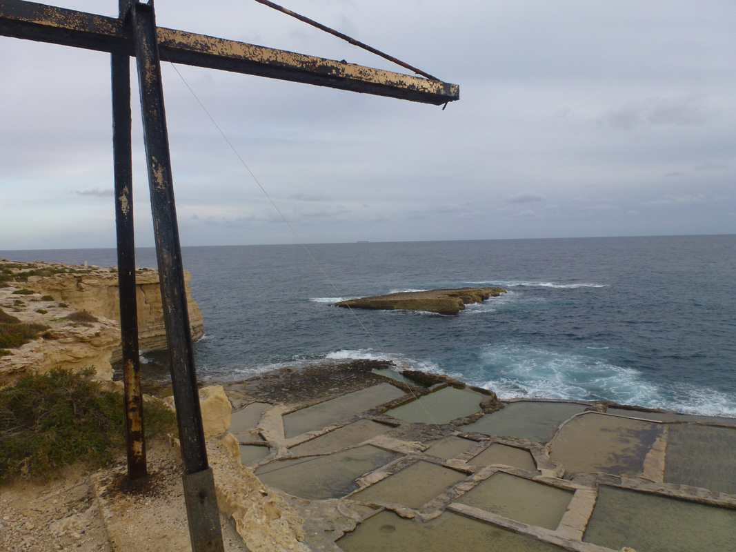
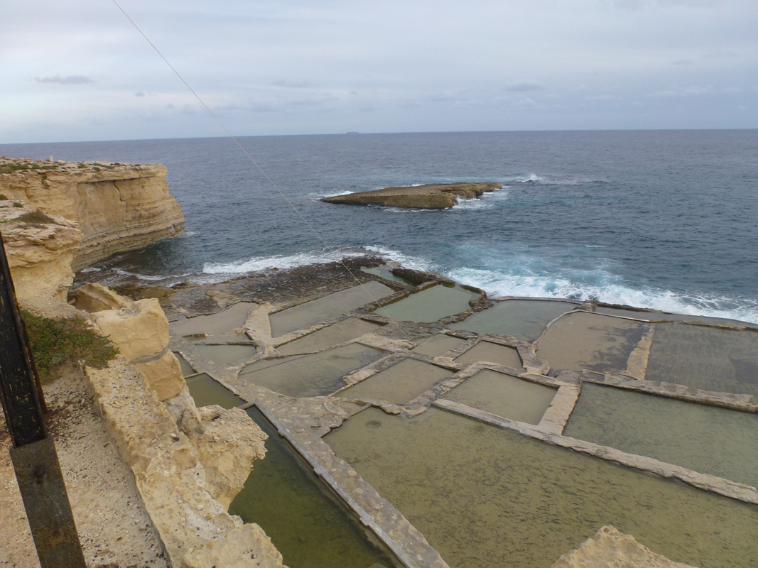
Taht l-Irdum are a series of salt pans, located in southern Malta, on the western peninsula of ll-Ponta ta’ Delimara, within Marsaxlokk. The site is not accessible to the public as it can be reached via a flight of stairs through a gated passageway. The salt pans cover an approximate area of 6,080m2.. The salt pans are still being used for salt harvesting due to the presence of industrial equipment for the hoisting of harvested salt on the overlaying cliff face. The harvested salt is stored in rooms adjacent to the hoisting equipment. The site is predominantly surrounded by natural habitat and a series of derelict structures. Kalanka Lighthouse is also located within a close proximity of the site. No vegetation was present growing within and around the site. The salt pans area classified as an Area of Ecological Importance under G.N. 400/96 and Area of High Landscape Value under G.N. No. 903/15 – GF 124/08 due to the presence of coastal cliffs. The site is within a No Trapping Zone under S.L 504.71.
Wetland data
Basic information
| Wetland location: | Marine/Coastal |
| Wetland type: | Artificial |
| Wetland area: | 0.60 Ha |
| Hydrological interaction: | - |
| Water salinity: | Salty (> 18.0 g/l) |
| Type of fresh water input: | Catchment area (precipitation) |
| Surface water runoff | Other |
| Open water area (%): | 76 - 95 |
| Hydroperiod: | Permanent |
Geographic information
| Census district: | South Eastern |
| Island: | Malta |
| Local council: | Marsaxlokk |
| Longitude: | 14.559510 East |
| Latitude: | 35.819390 North |
Biological significance
| Biological significance: | Low |
Ramsar wetland type
| Type | Coverage (%) |
| 5 -- Salt exploitation sites; salt pans, salines, etc. |
Property status
| Private |
| Protection status category | Protection status subcategory | Area's name | Code | Coverage area (%) | Legislation |
| National | Area of Ecological Importance | Irdumijiet Ta' Madwar il-Kosta mid-Dahla ta' San Tumas sas-Sarc | 14784 | 100 | Development Planning Act (Act VII of 2016) |
| National | Area of High Landscape Value | Diversi Rdumijiet | 555546316 | 100 | Development Planning Act (Act VII of 2016) |
CDDA protection status
| CDDA code | CDDA category |
| MT01 | Area of Ecological Importance |
| MT15 | Area of High Landscape Value |
Ecosystem services
| Type of ecosystem service | Ecosystem service | Scale of Βenefit (%) | Importance |
| Cultural services | Cultural heritage | ||
| Supporting services | Provision of habitat |
Activities on wetland
| Activity | Intensity |
| 020 = Resource conservation | High |
| 340 = Salt works | High |
| 690 = Other leisure and tourism impacts | Low |
| 800 = Landfill land reclamation and drying out | High |
| 920 = Drying out | High |
Activities on catchment area
| Activity | Intensity |
| 501 = paths tracks cycling tracks | High |
Impacts
| Impact | Intensity |
| EB- = Increase in aesthetic qualities | High |
| EE- = Increase of economic potential | High |
| EF- = Increase in protection from natural forces | Low |
| EO- = Increase potential for natural products | High |
| EU- = Increase of tourist/recreation potential | High |
Images